Sandwich
Location: Kasbach-Ohlenberg
Creator: Karin Humberg
Creator: Karin Humberg
GPS coordinates: 50.58077,7.25103
Latest update: July 20, 2025 16:25
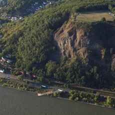
Erpeler Ley
405 m
Remagen Bridge
570 m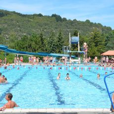
Freizeitbad Remagen
656 m
Jüdischer Friedhof (Erpel)
839 m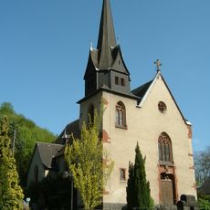
St. Michael (Kasbach)
681 m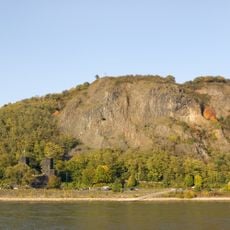
Erpeler Ley
362 m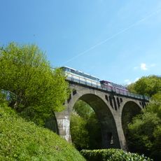
Kasbach-Ohlenberg railroad viaduct
864 m
Wayside shrine
591 m
Memorial stone, memorial
311 m
Liebeskraft
557 m
Scenic viewpoint
407 m
Ruine Ludendorff Brücke
582 m
Brückeneroberung 1945
583 m
Wayside cross
392 m
Ruine Ludendorff Brücke
595 m
Scenic viewpoint
629 m
Gedenken zu Ehren von Hans Eich
354 m
Wayside shrine, Christianity
660 m
Theater im Tunnel
470 m
Catholic church building, wayside cross, Christianity
711 m
Dead end street, scenic viewpoint
727 m
Wayside shrine, Christianity
733 m
Lapsus
746 m
Wayside cross
775 m
Scenic viewpoint
780 m
Catholic church building, wayside shrine, Christianity
786 m
Scenic viewpoint
813 m
Zeppelin-Stein
280 mReviews
Visited this place? Tap the stars to rate it and share your experience / photos with the community! Try now! You can cancel it anytime.
Discover hidden gems everywhere you go!
From secret cafés to breathtaking viewpoints, skip the crowded tourist spots and find places that match your style. Our app makes it easy with voice search, smart filtering, route optimization, and insider tips from travelers worldwide. Download now for the complete mobile experience.

A unique approach to discovering new places❞
— Le Figaro
All the places worth exploring❞
— France Info
A tailor-made excursion in just a few clicks❞
— 20 Minutes