ICH SEHE
Location: Senheim
Creator: Jürgen Waxweiler
Creator: Jürgen Waxweiler
GPS coordinates: 50.08479,7.21283
Latest update: November 20, 2025 01:34
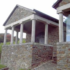
Römergrab von Nehren
2 km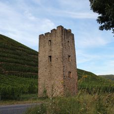
Wohnturm Hofgut Lehmen
2.5 km
Wohnturm Senheim
111 m
Insel Taubengruen
2.1 km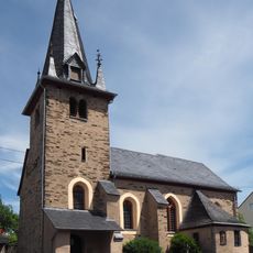
St. Agatha (Nehren)
1.3 km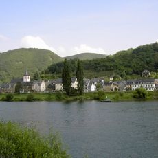
Moselgebiet von Schweich bis Koblenz
872 m
Schellen-Berg
2 km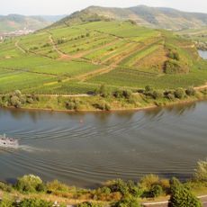
Moselhänge und Nebentäler der unteren Mosel
1.4 km
Scenic viewpoint
2.1 km
Eisernes Kreuz
645 m
Brückenheilige Moselbrücke Senheim
596 m
Summ- und Klangsteine
266 m
Lichtinstallation Senheim
582 m
Yachthafen Senheim
339 m
Steinreichskopp
1.5 km
Gelbe Bank
668 m
Aussichtspunkt
674 m
Schnittpunkte
288 m
Aussichtspunkt
869 m
Scenic viewpoint
671 m
Scenic viewpoint
792 m
Waldeslust
2.3 km
Obersthäuschen
667 m
War memorial, memorial
141 m
Wayside shrine
1.2 km
Bildstock an der Nikolausheck
1.4 km
Altr Schanze
1.1 km
750 Jahre Gemeinde Grenderich, 1239-1989
2.7 kmReviews
Visited this place? Tap the stars to rate it and share your experience / photos with the community! Try now! You can cancel it anytime.
Discover hidden gems everywhere you go!
From secret cafés to breathtaking viewpoints, skip the crowded tourist spots and find places that match your style. Our app makes it easy with voice search, smart filtering, route optimization, and insider tips from travelers worldwide. Download now for the complete mobile experience.

A unique approach to discovering new places❞
— Le Figaro
All the places worth exploring❞
— France Info
A tailor-made excursion in just a few clicks❞
— 20 Minutes