Zeitpunkte am Köhlerpfad 9
Location: Sensweiler
Creator: Gerd Edinger
Made from material: stone
Creator: Gerd Edinger
GPS coordinates: 49.77508,7.20310
Latest update: November 20, 2025 01:01
Ringkopf
2.7 km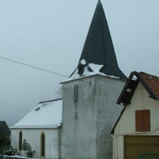
Protestant Church (Wirschweiler)
2.6 km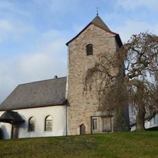
Protestant Church (Sensweiler)
461 m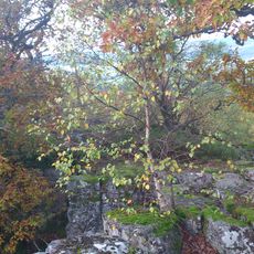
Kirschweiler Festung
2.5 km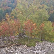
Rosselhalde
2.6 km
Badischbruch
1.5 km
Dudelsackbruch
2.5 km
Silberich
2.5 km
Steinbach Reservoir
932 m
Installation artwork, Work of art
1.3 km
Ringkopf
2.6 km
Wegzeichen 2
1.6 km
Work of art
563 m
Work of art
1.4 km
Geopark
971 m
Installation artwork, Work of art
1.3 km
Hohenfels
2 km
Scenic viewpoint
1.7 km
Besucher- und Informationszentrum "WasserWissensWerk"
1.7 km
Scenic viewpoint
2.5 km
Scenic viewpoint
1.4 km
Bärloch
2.7 km
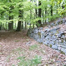
Keltischer Ringwall
2.7 km
Wüstung Croppenhof
262 m
Wüstung Croppenhof
237 m
Catholic church building, wayside shrine, Christianity
1.5 km
Wüstung Balsbach
2 km
Waterfall
1.6 kmReviews
Visited this place? Tap the stars to rate it and share your experience / photos with the community! Try now! You can cancel it anytime.
Discover hidden gems everywhere you go!
From secret cafés to breathtaking viewpoints, skip the crowded tourist spots and find places that match your style. Our app makes it easy with voice search, smart filtering, route optimization, and insider tips from travelers worldwide. Download now for the complete mobile experience.

A unique approach to discovering new places❞
— Le Figaro
All the places worth exploring❞
— France Info
A tailor-made excursion in just a few clicks❞
— 20 Minutes