Sichtachse
Location: Käshofen
Made from material: steel
GPS coordinates: 49.32513,7.39015
Latest update: November 22, 2025 13:40
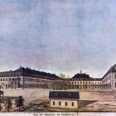
Karlsberg Castle
1.3 km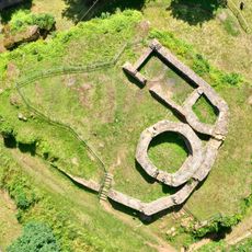
Merburg
1.8 km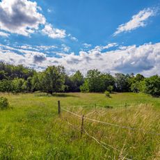
Alte Tongrube
2.3 km![Wald zwischen L119 im Norden, der Landesgrenze und Kirrberg im [Sued]Osten sowie Homburg im Westen](https://img9.digsty.com/k7FrTBDHFBvjoPV3LZixLQstsNGeeJq7NO0yJ5lwAfc/rs:fill:230:230:1/g:fp:0.5:0.5/czM6Ly9hcm91bmR1cy8xNC8xMTAwMzY5MS05MzFiYzQ2MS5qcGc.jpg)
Wald zwischen L119 im Norden, der Landesgrenze und Kirrberg im [Sued]Osten sowie Homburg im Westen
2.1 km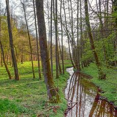
Lambsbachtal
645 m
Landschaftsschutzgebiet "Binnendüne nordöstlich Homburg" (L 6610-303)
2.2 km
Hirschbrunnen
1.2 km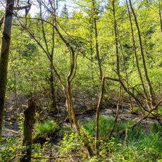
Lambsbachtal
1.3 km
Bear pit
115 m
Tschifflik Pavilion
398 m
Tobisberg
1.9 km
Orangery
1.4 km
NSG 'Lambsbachtal'
911 m
Binnendüne nordöstlich Homburg
2.3 km
Closenbruch
2.5 km
Ruine Merburg
1.7 km
Eiskeller
1.6 km
Scenic viewpoint
1.4 km
Marienbild
1.8 km
Memorial
2 km
Keltischer Grabhügel
848 m
Wayside cross
2.2 km
Memorial
2.3 km
Ruins
1.6 km
Wayside shrine
1.8 km
Brunnen am alten Forsthaus
1.8 km
Reiterbrunnen
561 m
Megalith, menhir, archaeological site
819 mReviews
Visited this place? Tap the stars to rate it and share your experience / photos with the community! Try now! You can cancel it anytime.
Discover hidden gems everywhere you go!
From secret cafés to breathtaking viewpoints, skip the crowded tourist spots and find places that match your style. Our app makes it easy with voice search, smart filtering, route optimization, and insider tips from travelers worldwide. Download now for the complete mobile experience.

A unique approach to discovering new places❞
— Le Figaro
All the places worth exploring❞
— France Info
A tailor-made excursion in just a few clicks❞
— 20 Minutes