Raureif
Location: Stadecken-Elsheim
Creator: Thomas Brenner
Creator: Thomas Brenner
GPS coordinates: 49.91145,8.13336
Latest update: July 20, 2025 16:54

Optische Telegrafenlinie Metz–Mainz
2 km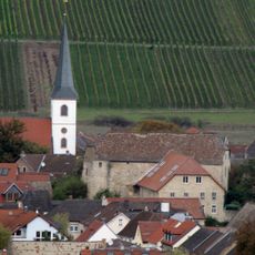
Burg Stadeck
175 m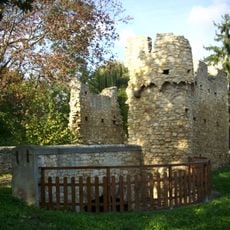
Elftausend-Maegde-Turm
1.3 km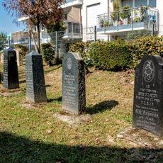
Jüdischer Friedhof (Essenheim)
2.7 km
Wasserbehälter
916 m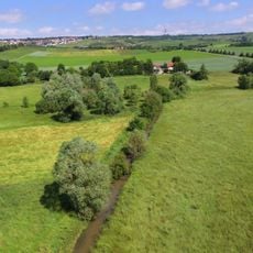
Am Laurenzihof
2.6 km
Woogwiesen/Bruchwiesen
576 m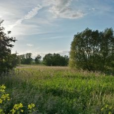
Im Mayen
1.6 km
Bingerwiese
2.4 km
Am Totenweg
984 m
Wanderfischgebiete im Rhein
3 km
Mörderhäufel
2.8 km
Ehrensäule
391 m
Blick zur Peterskirche
2 m
Scenic viewpoint
1.7 km
Telegrafenstation "Heidenhof"
2 km
Heinrich Hamm I
692 m
Tisch des Weines
1.6 km
Monument
2.5 km
Tor zur Champagne
2.6 km
Bilderweg Stadecken-Elsheim
5 m
Scenic viewpoint
1.7 km
Scenic viewpoint
2.8 km
Scenic viewpoint
1 km
Himmelsbergsheisje
2.8 km
Friedenskreuz
2.9 km
Jugenheim
2.9 km
Wayside cross, Christianity, Catholic church building
926 mReviews
Visited this place? Tap the stars to rate it and share your experience / photos with the community! Try now! You can cancel it anytime.
Discover hidden gems everywhere you go!
From secret cafés to breathtaking viewpoints, skip the crowded tourist spots and find places that match your style. Our app makes it easy with voice search, smart filtering, route optimization, and insider tips from travelers worldwide. Download now for the complete mobile experience.

A unique approach to discovering new places❞
— Le Figaro
All the places worth exploring❞
— France Info
A tailor-made excursion in just a few clicks❞
— 20 Minutes