Fire
Location: Northumberland
Creator: Tom Maley
Creator: Tom Maley
GPS coordinates: 55.17628,-1.64041
Latest update: November 18, 2025 05:25
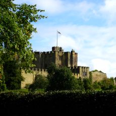
Bothal Castle
1 km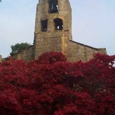
Church of St Andrew
1 km
Group Of 3 Stone Coffins And Font Bowl 10 Metres South Of Porch Of Church Of St Andrew
1 km
Cottages Nos 3 And 4
982 m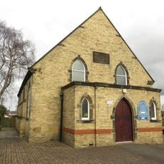
St Margaret
693 m
Bothal Castle Welbeck Estate Office And Attached Outbuildings Around Stable Yard
1.1 km
Bothal War Memorial
1 km
Cottages Nos 1 And 2
987 m
Bothal Mill House And Adjacent Outbuilding
798 m
Front Wall And Gate Piers To Bothal Cottages (1-6), Village Hall And Adjacent House
987 m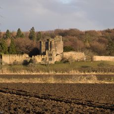
Bothal Castle Remains Of Curtain Wall To South Of Residential Block
1.1 km
Numbers 1-7 North Farm
836 m
Cookswell House
1.1 km
Cottages Nos 5 And 6
974 m
Garden House With Attached Outbuilding To North
1 km
The Joiners Shop
973 m
Garden Walls To South And East Of Pegswood Farm
779 m
Churchyard Wall, Piers And Gate To South-West Of Church Of St Andrew
1 km
Cart Shed And Wall To West Of Pegswood Farm
810 m
Outbuilding 20 Metres North Of Pegswood Farm
798 m
Pegswood Farm
790 m
Garden And Terrace Walls To South Of Bothal Mill House
821 m
Farm Buildings And Wall To North East Of East Farmhouse
696 m
Garden Walls To South Of East Farmhouse
677 m
Village Hall And Attached House
964 m
Smalridge Memorial 5 Metres North Of Aisle Of Church Of St Andrew
1 km
East Farmhouse
684 m
Colliers Hill
925 mReviews
Visited this place? Tap the stars to rate it and share your experience / photos with the community! Try now! You can cancel it anytime.
Discover hidden gems everywhere you go!
From secret cafés to breathtaking viewpoints, skip the crowded tourist spots and find places that match your style. Our app makes it easy with voice search, smart filtering, route optimization, and insider tips from travelers worldwide. Download now for the complete mobile experience.

A unique approach to discovering new places❞
— Le Figaro
All the places worth exploring❞
— France Info
A tailor-made excursion in just a few clicks❞
— 20 Minutes