Táknatréð
Location: Urriðaholt
Location: Garðabær
Creator: Gabríela Friðriksdóttir;Mathias Augustyniak;Michael Amzalag
Creator: Gabríela Friðriksdóttir;Mathias Augustyniak;Michael Amzalag
GPS coordinates: 64.06968,-21.90081
Latest update: July 20, 2025 18:04
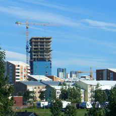
Smáratorg Tower
3.8 km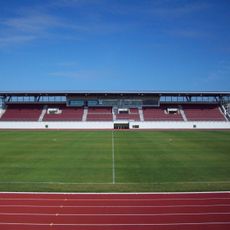
Kópavogsvöllur
3.8 km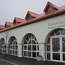
Hafnarborg
2.7 km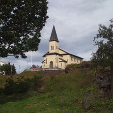
Hafnarfjordur Free Church
2.6 km
Icelandic Museum of Design and Applied Art
2.4 km
Hellisgerði
2.8 km
Phare de Hafnarfjörður
3.1 km
Landslag
2.7 km
Samspil
1.9 km
Bjargfesta
2.6 km
Work of art, sculpture
2.6 km
Jötnar
2.5 km
Við Ægisdyr
2.7 km
Hamarinn
2.4 km
Uppsprettan
2.2 km
Leirdalsvöllur
2.7 km
Hringsjá og eyktir
2.7 km
Work of art
2.7 km
Work of art, sculpture
2.5 km
Hönnun
2.8 km
Bjarni Sívertsen
2.9 km
Scenic viewpoint
1.3 km
Stúpa
3.2 km
Leikhúsið
3.4 km
Upphaf
3.7 km
Setbergsvöllur
1.2 km
Scenic viewpoint
3.8 km
Urriðavöllur
995 mReviews
Visited this place? Tap the stars to rate it and share your experience / photos with the community! Try now! You can cancel it anytime.
Discover hidden gems everywhere you go!
From secret cafés to breathtaking viewpoints, skip the crowded tourist spots and find places that match your style. Our app makes it easy with voice search, smart filtering, route optimization, and insider tips from travelers worldwide. Download now for the complete mobile experience.

A unique approach to discovering new places❞
— Le Figaro
All the places worth exploring❞
— France Info
A tailor-made excursion in just a few clicks❞
— 20 Minutes