XII
Location: Klin
Location: okres Námestovo
GPS coordinates: 49.46185,19.45097
Latest update: November 9, 2025 13:14
Podbeskydská brázda
4.8 km
Plátenícka kúria
3.9 km
Gropa
2.4 km
Socha sv. Jána Nepomuckého, socha
4 km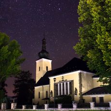
Kostol Navštívenia P. M.
4 km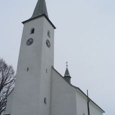
Farský kostol sv. Petra a Pavla
4.8 km
Vahanov Vrch
1.4 km
Slepčanka
4.6 km
Prícestný kríž, reliéf
4.8 km
Plátenícka kúria, Skyčákovská
3.8 km
Prícestný kríž, kríž s korpusom
4.8 km
Prícestný kríž, pilier s podstavcom
4.8 km
Plátenícky dom, dom remeselnícky II.
4.3 km
Plátenícky dom, dom remeselnícky I.
4.3 km
XIV
169 m
XI
135 m
X
276 m
IX
393 m
VIII
515 m
VII
634 m
VI
1 km
V
1.2 km
IV
1.3 km
III
1.5 km
II
1.6 km
I
1.9 km
Painting, Work of art
2.5 km
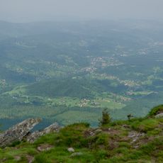
Scenic viewpoint
2.5 kmReviews
Visited this place? Tap the stars to rate it and share your experience / photos with the community! Try now! You can cancel it anytime.
Discover hidden gems everywhere you go!
From secret cafés to breathtaking viewpoints, skip the crowded tourist spots and find places that match your style. Our app makes it easy with voice search, smart filtering, route optimization, and insider tips from travelers worldwide. Download now for the complete mobile experience.

A unique approach to discovering new places❞
— Le Figaro
All the places worth exploring❞
— France Info
A tailor-made excursion in just a few clicks❞
— 20 Minutes