
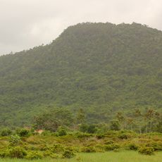
Veal Renh Roundabout, view to east .
Location: ស្រុកព្រៃនប់
Website: https://drive.google.com/file/d/0B7Fwb6PHLH-JaVZ4ZWQybGtiWEk/view?usp=sharing
Website: https://drive.google.com/file/d/0B7Fwb6PHLH-JaVZ4ZWQybGtiWEk/view?usp=sharing
GPS coordinates: 10.70536,103.80801
Latest update: October 24, 2025 18:53

Ream National Park
23.6 km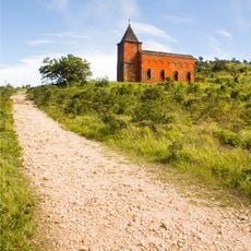
Bokor church
25 km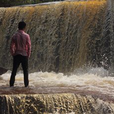
Kbal Chhay Waterfall
22 km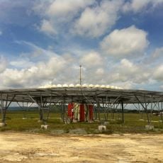
VOR/DME at Sihanouk International Airport
22.2 km
100 'Rice' Fields (rock fields)
22.6 km
Scenic viewpoint
19.8 km
West Line Tourist Site
25.9 km
500 'Rice' Fields (rock fields)
18.7 km
Preynub Eroom
1.3 km
Meditation Stone
18.7 km
Temple Shape Stone
18.8 km
Sacred Meditation Area
16.5 km
Fleischfressende Kannenpflanzen
16.9 km
Old Colonial Catholic Church
25 km
Prek Thnout Rapids
19.1 km
Vid wedding house
19.9 km
Bokor Viewpoint
25.9 km
Scenic viewpoint
2.1 km
Scenic viewpoint
23.5 km
Scenic viewpoint
21.9 km
Scenic viewpoint
25 km
Scenic viewpoint
22 km
Scenic viewpoint
4.5 km
LandMap
15.7 km
Scenic viewpoint
24.4 km
Scenic viewpoint
24.3 km
Scenic viewpoint
17 km
Scenic viewpoint
25.6 kmReviews
Visited this place? Tap the stars to rate it and share your experience / photos with the community! Try now! You can cancel it anytime.
Discover hidden gems everywhere you go!
From secret cafés to breathtaking viewpoints, skip the crowded tourist spots and find places that match your style. Our app makes it easy with voice search, smart filtering, route optimization, and insider tips from travelers worldwide. Download now for the complete mobile experience.

A unique approach to discovering new places❞
— Le Figaro
All the places worth exploring❞
— France Info
A tailor-made excursion in just a few clicks❞
— 20 Minutes