
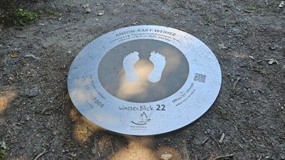
Wasser.Blick 22 Anton-Raky-Weiher
Location: Wegberg
Accessibility: Accessibile in sedia a rotelle
Website: https://www.npsn.de/wb-anton-raky-weiher
Website: https://npsn.de/wb-anton-raky-weiher
GPS coordinates: 51.14677,6.19217
Latest update: November 21, 2025 07:37
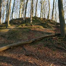
Motte Aldeberg
265 m
Dalheimer Mühle Wegberg-Dalheim
2 km
Dalheimer Mühle
2 km
Rödgener Mühle Wegberg-Rödgen
59 m
St. Adelgundis (Arsbeck)
1.4 km
St. Rochus (Dalheim-Rödgen)
398 m
Helpensteiner Mühle
1.2 km
Helpensteiner Bachtal, oberes Schaagbachtal und Petersholz
2 km
Zisterzienserinnenabtei Dalheim
1.5 km
St. Josef-Kapelle
886 m
LSG-Schwalmplatte
2.1 km
Evangelische Erlöserkirche
717 m
Wegberg observatory
1.3 km
Helpensteiner Bachtal-Rothenbach
630 m
Meinweg
2.1 km
Arsbecker Bruch
1.3 km
Mittelalterliche Wallanlage
2.3 km
Motte Teufelsberg
1.2 km
Archaeological site
2 km
Memorial
1.8 km
Archaeological site
2.2 km
Wayside cross
853 m
Wegekreuz
1.2 km
War memorial, memorial
1.4 km
Christianity, Catholic church building, wayside cross
2 km
Gedenkstätte für sieben ermordete Zwangsarbeiterinnen
932 m
Christianity, Catholic church building, wayside cross
248 m
Gedenkkapelle
974 mReviews
Visited this place? Tap the stars to rate it and share your experience / photos with the community! Try now! You can cancel it anytime.
Discover hidden gems everywhere you go!
From secret cafés to breathtaking viewpoints, skip the crowded tourist spots and find places that match your style. Our app makes it easy with voice search, smart filtering, route optimization, and insider tips from travelers worldwide. Download now for the complete mobile experience.

A unique approach to discovering new places❞
— Le Figaro
All the places worth exploring❞
— France Info
A tailor-made excursion in just a few clicks❞
— 20 Minutes