
Aussichts- und Rastplatz "Mühlenberg"
Location: Trimbs
Website: https://goo.gl/maps/kHPo8ddtYh9SMqRH7
Website: https://goo.gl/maps/kHPo8ddtYh9SMqRH7
GPS coordinates: 50.32314,7.30549
Latest update: November 16, 2025 00:56

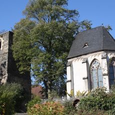
Alte Kirche (Welling)
697 m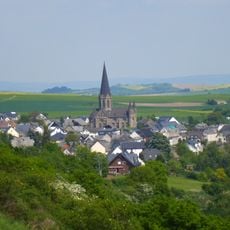
St. Paulinus (Welling)
913 m
Aussichtspunkt Burberg
968 m
Schäpplöffel
925 m
Ölmühle (frühere "Ollesmill") 1:12,5 Nachbildung
711 m
Schiefertor an der "Barbara"
1.4 km
Baltesgritte Hannes
597 m
Hochkreuz
1.5 km
Aussichts- und Rastplatz "Burgkopf"
1.6 km
Rast- und Aussichtsplatz "Kretzer's Lay"
941 m
Kastesch Bersch
222 m
Trimbser Schweiz
172 m
Felssporn Kretzer's Lay
965 m
Aussichts- und Rastplatz "Im Burgberg"
1 km
Modell eines römischen Wachturms
407 m
Dorfplatz
1.2 km
Scenic viewpoint
878 m
Aussichts- und Rastplatz Nettehof
1.2 km
Scenic viewpoint
1.1 km
Aussichts- und Rastplatz "Mühlenberg"
24 m
Antike Treppe
46 m
Scenic viewpoint
81 m
Wayside shrine
526 m
Memorial
439 m
Scenic viewpoint
53 m
Catholic church building, wayside cross, Christianity
581 m
Wayside cross
432 m
Nette Wasserfall am Traumpfad
1.8 kmReviews
Visited this place? Tap the stars to rate it and share your experience / photos with the community! Try now! You can cancel it anytime.
Discover hidden gems everywhere you go!
From secret cafés to breathtaking viewpoints, skip the crowded tourist spots and find places that match your style. Our app makes it easy with voice search, smart filtering, route optimization, and insider tips from travelers worldwide. Download now for the complete mobile experience.

A unique approach to discovering new places❞
— Le Figaro
All the places worth exploring❞
— France Info
A tailor-made excursion in just a few clicks❞
— 20 Minutes