
63
Location: Hemmerden
Location: Grevenbroich
Inception: January 1, 1771
Reference: 63
Website: http://de.wikipedia.org/wiki/Datei:63_Wegekreuz,_Mauristra%C3%9Fe-Pfannenstra%C3%9Fe_%28Hemmerden%29.jpg
GPS coordinates: 51.12222,6.58767
Latest update: November 21, 2025 13:07

St. Martinus (Bedburdyck)
1.8 km
Burg Noithausen
1.8 km
Jüdischer Friedhof
748 m
St. Mariä Geburt
1.8 km
Wayside cross
1.7 km
Wayside cross
1.6 km
Tourist attraction
1.7 km
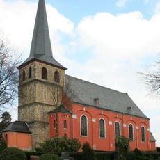
St. Martinus
1.8 km
44
483 m
101
272 m
Heiligenhäuschen
1.8 km
Wayside cross
1.8 km
Zum Tag der Deutschen Einheit
1.9 km
Wayside shrine
1.9 km
Dycker Mühle
1.5 km
Wayside cross, tourist attraction
1.8 km
Wayside cross
232 m
Ehrenmal
264 m
Wayside cross
337 m
Memorial
203 m
Wayside cross
1.9 km
Christianity, wayside shrine
762 m
Wayside cross
1.6 km
Wayside cross
224 m
Wayside cross
3 m
Wayside cross
616 m
Wayside cross
1.9 km
Wayside cross
982 mReviews
Visited this place? Tap the stars to rate it and share your experience / photos with the community! Try now! You can cancel it anytime.
Discover hidden gems everywhere you go!
From secret cafés to breathtaking viewpoints, skip the crowded tourist spots and find places that match your style. Our app makes it easy with voice search, smart filtering, route optimization, and insider tips from travelers worldwide. Download now for the complete mobile experience.

A unique approach to discovering new places❞
— Le Figaro
All the places worth exploring❞
— France Info
A tailor-made excursion in just a few clicks❞
— 20 Minutes