148
Location: Neukirchen
Location: Grevenbroich
Reference: 148
GPS coordinates: 51.12193,6.69505
Latest update: November 21, 2025 12:16

Haus Horr
1.6 km
Jüdischer Friedhof
1.4 km
Windenergieanlagen Neuss-Hoisten
1.3 km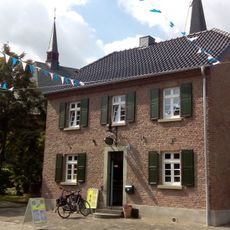
185
775 m
Wayside cross
1.2 km
Wayside shrine, Christianity
967 m
Et Lingche
490 m
Davidstern
1.2 km
Stele
1.5 km
Work of art, sculpture
481 m
Statue, Work of art
736 m
147
93 m
Sankt Jakobus der Ältere
779 m
Tourist attraction
1.6 km
Gurkenfässer der Firma pegels
383 m
Pfarrbüro und Pfarrhaus Neukirchen
777 m
Wayside cross
1.6 km
Wayside cross
1 km
Memorial
853 m
Wayside cross
1.2 km
Water well
837 m
Memorial, war memorial
776 m
Obelisk, memorial
764 m
Memorial
768 m
Motte
781 m
Catholic church building, wayside cross, Christianity
803 m
Memorial, commemorative plaque
797 m
Catholic church building, wayside cross, Christianity
951 mReviews
Visited this place? Tap the stars to rate it and share your experience / photos with the community! Try now! You can cancel it anytime.
Discover hidden gems everywhere you go!
From secret cafés to breathtaking viewpoints, skip the crowded tourist spots and find places that match your style. Our app makes it easy with voice search, smart filtering, route optimization, and insider tips from travelers worldwide. Download now for the complete mobile experience.

A unique approach to discovering new places❞
— Le Figaro
All the places worth exploring❞
— France Info
A tailor-made excursion in just a few clicks❞
— 20 Minutes