
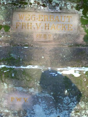
Ritterstein 122 "Weg erbaut Frh. v. Hacke 1737"
Location: Elmstein
Reference: 112
Subject:
Inscription: WEG-ERBAUT FRH. v. HACKE 1737 PWV.
Made from material: sandstone
GPS coordinates: 49.35375,7.85614
Latest update: November 22, 2025 22:46

Speyerbrunner Woog
1.2 km
St. Wendelinus und Hubertus
1.3 km
Leiterberg
2.8 km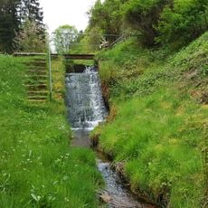
Augustenwoog
2.3 km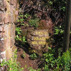
Ritterstein 121 "Frh. v. Haacke Holsriese"
1.3 km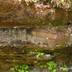
Ritterstein 109 "Welterstal"
2.8 km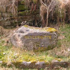
Ritterstein 93 "Hexlerhütte"
2.2 km
Ritterstein 110 "Welterstal"
2.8 km
Eulenberg
2.4 km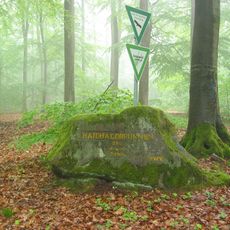
Ritterstein 108 "Haidhaldbrunnen 220 Schr."
2.4 km
Ritterstein 126 "Altes Forsthaus 15 Schr."
1.6 km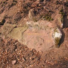
Ritterstein 94 "Erzgruben"
1.3 km
Leitenberger Platte
2.7 km
Blechkiefer
1.2 km
Haidbrunnen
2.4 km
Scenic viewpoint
765 m
Ritterstein 112 "R. Forsthaus Mückenwies"
1.6 km
Ritterstein 105 "Gratsohl"
2.6 km
Ritterstein 111 "Johanniskreuz"
2.9 km
Ritterstein 254 "Speyerbach-Ursprung"
1.1 km
Netzwerk-Globus
2.8 km
Scenic viewpoint
1.2 km
Weir
1.2 km
Parkplatz Stüterhof 1985
2.6 km
Reinhart Melzer
2 km
Walter Fuchs
1.4 km
Waterfall
2.7 km
Waterfall
2.8 kmReviews
Visited this place? Tap the stars to rate it and share your experience / photos with the community! Try now! You can cancel it anytime.
Discover hidden gems everywhere you go!
From secret cafés to breathtaking viewpoints, skip the crowded tourist spots and find places that match your style. Our app makes it easy with voice search, smart filtering, route optimization, and insider tips from travelers worldwide. Download now for the complete mobile experience.

A unique approach to discovering new places❞
— Le Figaro
All the places worth exploring❞
— France Info
A tailor-made excursion in just a few clicks❞
— 20 Minutes