Orgel von St. Andreas
Location: Soest
Inception: January 1, 1431
Website: https://de.wikipedia.org/wiki/Datei:60327718_Ost%C3%B6nnen.jpg
Website: https://de.wikipedia.org/wiki/Datei:60327718_Ost%C3%B6nnen.jpg
GPS coordinates: 51.54827,8.00086
Latest update: November 23, 2025 20:01
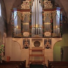
Organo di S. Andrea
9 m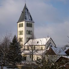
Church of St. Andrew in Ostönnen
9 m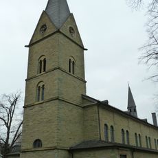
St. Cäcilia (Westönnen)
2.8 km
Galeriegrab Ostönnen
296 m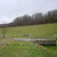
Hochwasserrückhaltebecken Höhbergtal-Gerlingen
2.3 km
Mühlenbach-Siepenbach
2.3 km
LSG-Ostoenner Linde
2.1 km
Catholic church building, wayside shrine, Christianity
2.6 km
Christianity, Catholic church building, wayside shrine
1.5 km
Mural, Work of art
1.4 km
Denkmal zur Flutkatastrophe 1968
225 m
Ehrenmal
2 km
Gedenktafel an die abgestürzte Lancaster der Royal Air Force im Jahre 1943
1.3 km
Wayside shrine, Christianity
2.7 km
Campingclub Bochum
2.4 km
Memorial, war memorial
2.8 km
Catholic church building, wayside cross, Christianity
368 m
Wayside shrine, Christianity, Catholic church building
2.7 km
Wegmarke Galgenvögel
2.7 km
Wayside cross
2 km
Wayside shrine
2.4 km
Wayside cross
2.8 km
Casper Theodor von Papen Grabstätte
2.8 km
Wayside shrine
1.4 km
Wayside cross
2.8 km
Wayside shrine
2.7 km
Wayside cross
2.8 km
Wayside cross
2.8 kmReviews
Visited this place? Tap the stars to rate it and share your experience / photos with the community! Try now! You can cancel it anytime.
Discover hidden gems everywhere you go!
From secret cafés to breathtaking viewpoints, skip the crowded tourist spots and find places that match your style. Our app makes it easy with voice search, smart filtering, route optimization, and insider tips from travelers worldwide. Download now for the complete mobile experience.

A unique approach to discovering new places❞
— Le Figaro
All the places worth exploring❞
— France Info
A tailor-made excursion in just a few clicks❞
— 20 Minutes