
Puits Sainte-Marthe
Location: Stiring-Wendel
Inception: January 1, 1852
GPS coordinates: 49.20257,6.93146
Latest update: November 20, 2025 03:02

Hauptfriedhof Saarbrücken
1.9 km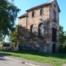
Puits Sainte-Marthe
6 m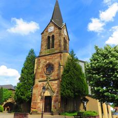
Église Saint-Joseph de Schoeneck
1.8 km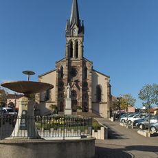
Église Saint-François de Stiring-Wendel
452 m
Église Sainte-Croix de Cité du Creuzberg
1.7 km
Église Saint-Roch de Verrerie Sophie
1.4 km
Église luthérienne de Stiring-Wendel
857 m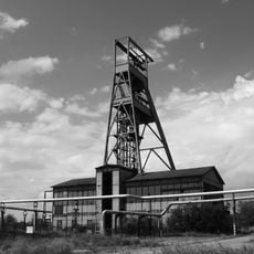
Puits Simon
1.3 km
Wayside cross, Christianity
2 km
Grubenunglück 1907 Vuillemin
743 m
77. Infanterie-Regiment
1.8 km
Monet
1.6 km
Fliegeropfer
1.7 km
Memorial cross, memorial
1.7 km
Work of art, sculpture
1.8 km
Wayside shrine
231 m
Wayside cross, Christianity
2 km
Scenic viewpoint
1 km
Wayside cross
1.2 km
Wayside cross
1.5 km
Memorial
827 m
Bomb crater
2 km
Christianity, wayside cross
613 m
Memorial, memorial stone
1.8 km
Catholic church building, wayside cross, Christianity
607 m
Alliiertenfriedhof
2 km
1914/18
1.9 km
Christianity, war grave, military cemetery, memorial cross, memorial
1.9 kmReviews
Visited this place? Tap the stars to rate it and share your experience / photos with the community! Try now! You can cancel it anytime.
Discover hidden gems everywhere you go!
From secret cafés to breathtaking viewpoints, skip the crowded tourist spots and find places that match your style. Our app makes it easy with voice search, smart filtering, route optimization, and insider tips from travelers worldwide. Download now for the complete mobile experience.

A unique approach to discovering new places❞
— Le Figaro
All the places worth exploring❞
— France Info
A tailor-made excursion in just a few clicks❞
— 20 Minutes