
Ringebu stavkyrkje
Location: Ringebu
Inception: January 1, 1220
Accessibility: Acessível para cadeira de rodas
Fee: Yes
Website: https://www.kirkebyggdatabasen.no/KBDBweb/getPublicImage.aspx?vedleggId=60F061D7-94B7-44F3-88CC-6AE8A3569F40
Operator: Ringebu kyrkjelege fellesråd
GPS coordinates: 61.50934,10.17292
Latest update: October 26, 2025 12:16

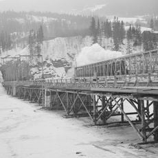
Randklev Railway Bridge
1.9 km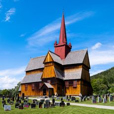
Ringebu Stave Church
46 m
Dale-Gudbrand's farm
11.8 km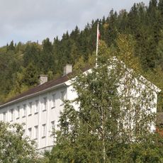
Ringebu prestegård
182 m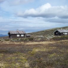
Jammerdalsbu
12.7 km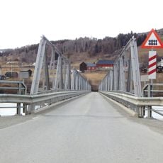
Hundorp Bridge
11.7 km
Ringebu ungdomssenter
3 km
Hove
12.2 km
Bjørgerønningen
14.9 km
Sør-Fron prestegård
13.3 km
Bjørgerønningen
14.9 km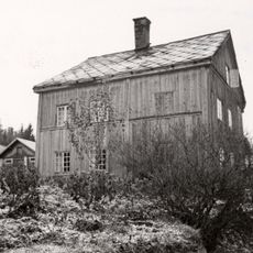
Graffer
10.1 km
Mappa Mundi
11.8 km
Myfallet - Bottom Viewpoint
14.6 km
Ringebudragen
2.9 km
Work of art, sculpture
2.9 km
Statue, Work of art
3 km
Scenic viewpoint, bench
7.8 km
Myfallet - Top Viewpoint
14.7 km
Mammuten
6.3 km
Høgåsen
13.6 km
Myfallet Middle Viewpoint (unofficial, best view)
14.7 km
Scenic viewpoint
10.9 km
Scenic viewpoint
10.6 km
Scenic viewpoint
10.5 km
Observation tower, scenic viewpoint, Mobile light tower, tower
11.4 km
Scenic viewpoint
5.1 km
Scenic viewpoint
12.6 kmReviews
Visited this place? Tap the stars to rate it and share your experience / photos with the community! Try now! You can cancel it anytime.
Discover hidden gems everywhere you go!
From secret cafés to breathtaking viewpoints, skip the crowded tourist spots and find places that match your style. Our app makes it easy with voice search, smart filtering, route optimization, and insider tips from travelers worldwide. Download now for the complete mobile experience.

A unique approach to discovering new places❞
— Le Figaro
All the places worth exploring❞
— France Info
A tailor-made excursion in just a few clicks❞
— 20 Minutes