Kandalaksha Nature Reserve
20.4 km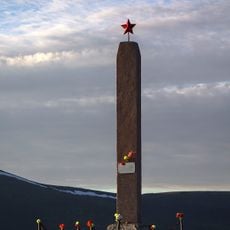
Место стоянки партизанского отряда
13 km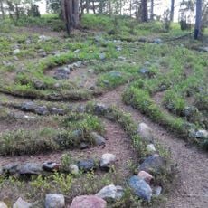
Stone labyrinths in Kandalaksha
22.7 km
Поселение, относящееся к концу неолитической эпохи
19.2 km
Нива 12 (поселение)
25.3 km
Нива 13 (поселение)
25.1 km
Нива 14 (поселение)
24.9 km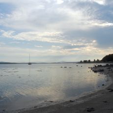
Стоянка эпохи позднего неолита
22.9 km
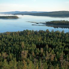
Scenic viewpoint
24 km
Вид на гору Железная
21.7 km
Северная (Северный Купол)
20.3 km
Scenic viewpoint
22.8 km
Scenic viewpoint
20.9 km
Лучший вид на бухту
24.1 km
Каменный лабиринт "Вавилон"
22.7 km
Scenic viewpoint
22.4 km
Scenic viewpoint
21.2 km
Seid stone
24.9 km
Scenic viewpoint
22.2 km
Scenic viewpoint
616 m
Scenic viewpoint
634 m
Крест
23.2 km
Память Колвицы
86 m
Устинов Евгений
22.7 km
Руины деревянной ГЭС
617 m
Waterfall
3 km
Колвицкие Водопады (правая протока)
624 m
Колвицкие водопады (левая протока)
697 mReviews
Visited this place? Tap the stars to rate it and share your experience / photos with the community! Try now! You can cancel it anytime.
Discover hidden gems everywhere you go!
From secret cafés to breathtaking viewpoints, skip the crowded tourist spots and find places that match your style. Our app makes it easy with voice search, smart filtering, route optimization, and insider tips from travelers worldwide. Download now for the complete mobile experience.

A unique approach to discovering new places❞
— Le Figaro
All the places worth exploring❞
— France Info
A tailor-made excursion in just a few clicks❞
— 20 Minutes