Wayside shrine
Location: Rohrendorf bei Krems
GPS coordinates: 48.41304,15.66171
Latest update: November 13, 2025 14:08
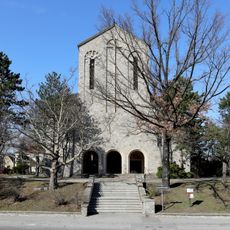
Pfarrkirche Lerchenfeld
2.1 km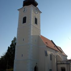
Pfarrkirche Rohrendorf bei Krems
806 m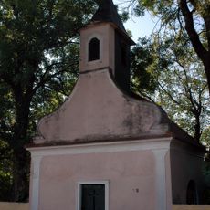
Kapelle hl. Sebastian in Neuweidling
725 m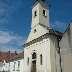
Kapelle
1.7 km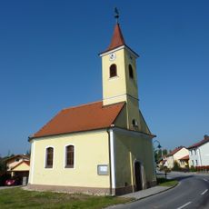
Ortskapelle
1.9 km
Silo Hafen Krems
1.8 km
Gemeindeamt Rohrendorf bei Krems
774 m
Gutshof/Meierhof , Stadel und Einfriedung
1.8 km
Volksschule
842 m
Wasserpumpwerk der Stadt Krems
1.8 km
Work of art, sculpture
1.9 km
Christianity, traffic island, wayside shrine
1.3 km
Work of art, statue
1.4 km
Statue, Work of art
857 m
Weinlandhalle
805 m
Scenic viewpoint
1.7 km
Scenic viewpoint
1.6 km
Scenic viewpoint
1.9 km
Heinz-Conrads-Gedenktor
1.7 km
Ortswächter Ost
1.5 km
Wayside shrine
1.4 km
Memorial, war memorial
833 m
Hl Urban
1.5 km
Hl Sebastian
861 m
Hl Koloman
838 m
Wayside shrine
960 m
50 Jahr Bestandsjubiläum des NÖ Bauernbundes
1.2 km
25jähr. Bestandsjubiläum des n.ö. Bauernbundes
1.2 kmReviews
Visited this place? Tap the stars to rate it and share your experience / photos with the community! Try now! You can cancel it anytime.
Discover hidden gems everywhere you go!
From secret cafés to breathtaking viewpoints, skip the crowded tourist spots and find places that match your style. Our app makes it easy with voice search, smart filtering, route optimization, and insider tips from travelers worldwide. Download now for the complete mobile experience.

A unique approach to discovering new places❞
— Le Figaro
All the places worth exploring❞
— France Info
A tailor-made excursion in just a few clicks❞
— 20 Minutes