V
Location: Stožec
Inscription: Šimon Kyrénský pomáhá Ježíši nést kříž
GPS coordinates: 48.87917,13.81405
Latest update: November 12, 2025 17:24
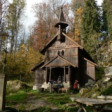
Kaple Panny Marie (Stožec)
841 m
Tussetberg
1.4 km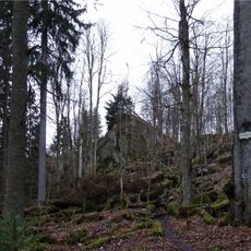
Stožecká skála
981 m
Stožec
1 km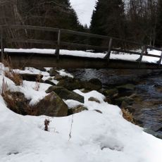
Lávka přes Studenou Vltavu severovýchodně od Stožce
2.2 km
Myslivna
2.2 km
XIII
792 m
X
599 m
Wayside cross
855 m
Wayside cross
2.2 km
Stožecká skála
822 m
KM / JH - 30.8.1889
803 m
Kreuz -Gravur im Bodenfelsen
799 m
XIV
856 m
Militär-Panzer
1.8 km
XII
752 m
XI
675 m
Stožecká skála
823 m
IX
481 m
VIII
389 m
VII
323 m
VI
131 m
III
250 m
II
432 m
I
585 m
Wayside cross
1.7 km
Wayside cross
1.7 km
Wayside cross
1.9 kmReviews
Visited this place? Tap the stars to rate it and share your experience / photos with the community! Try now! You can cancel it anytime.
Discover hidden gems everywhere you go!
From secret cafés to breathtaking viewpoints, skip the crowded tourist spots and find places that match your style. Our app makes it easy with voice search, smart filtering, route optimization, and insider tips from travelers worldwide. Download now for the complete mobile experience.

A unique approach to discovering new places❞
— Le Figaro
All the places worth exploring❞
— France Info
A tailor-made excursion in just a few clicks❞
— 20 Minutes