
1219401 - A
Location: Quins
Reference: 1219401 - A
Website: https://fiches-geodesie.ign.fr/fiches/index.php?module=e&action=fichepdf&source=carte&sit_no=1219401
GPS coordinates: 44.23270,2.37300
Latest update: November 3, 2025 14:29
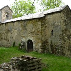
Chapelle Saint-Clair de Verdun
768 m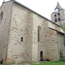
Église Saint-Christophe de Sauveterre-de-Rouergue
4.5 km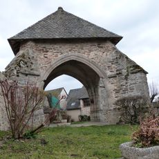
Oratoire de Gramond
3.7 km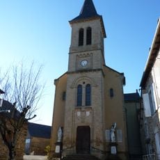
Église Saint-Blaise de Salan
3.9 km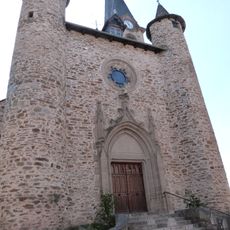
Église Saint-Martin de Naucelle
4.6 km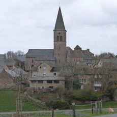
Église Sainte-Madeleine de Gramond
3.6 km
Église Saint-Pierre-ès-Lien de Quins
61 m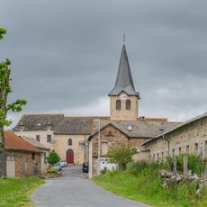
Saint Lupus church in Jouels
4.5 km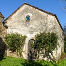
Chapelle Saint-Vincent de Lugan
1.4 km
Wayside cross
919 m
Wayside cross
1.3 km
Wayside cross
1.5 km
Wayside cross
1.6 km
Wayside cross
1.6 km
Wayside cross
3.6 km
Wayside cross
3.6 km
Memorial, war memorial
3.6 km
Memorial, war memorial
1.4 km
Wayside cross
1.4 km
Catholic church building, wayside cross
3.8 km
Wayside cross
463 m
Wayside cross
4 km
Wayside cross, Catholic church building
4.1 km
Catholic church building, wayside cross
4.2 km
Wayside shrine
4.3 km
Wayside shrine
120 m
Monument aux Morts
4.5 km
Wayside cross
95 mReviews
Visited this place? Tap the stars to rate it and share your experience / photos with the community! Try now! You can cancel it anytime.
Discover hidden gems everywhere you go!
From secret cafés to breathtaking viewpoints, skip the crowded tourist spots and find places that match your style. Our app makes it easy with voice search, smart filtering, route optimization, and insider tips from travelers worldwide. Download now for the complete mobile experience.

A unique approach to discovering new places❞
— Le Figaro
All the places worth exploring❞
— France Info
A tailor-made excursion in just a few clicks❞
— 20 Minutes