Catholic church building, wayside cross
Location: Saint-Pons-de-Thomières
GPS coordinates: 43.49386,2.76561
Latest update: November 24, 2025 10:08
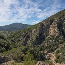
Haut-Languedoc Regional Natural Park
530 m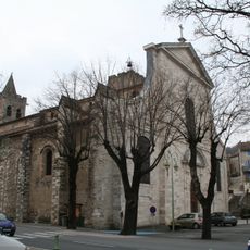
Saint-Pons-de-Thomières Cathedral
748 m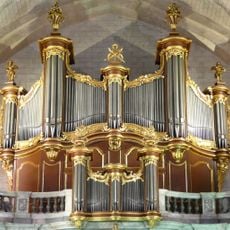
Pipe organ of Cathédrale Saint-Pons de Saint-Pons-de-Thomières
631 m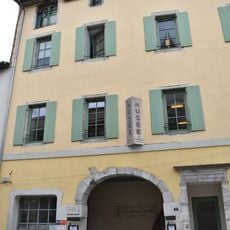
Musée de préhistoire régionale de Saint-Pons-de-Thomières
798 m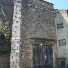
Église Saint-Martin-du-Jaur de Saint-Pons-de-Thomières
855 m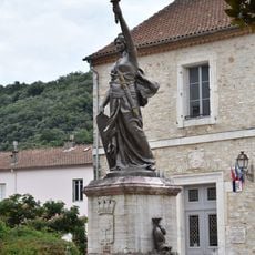
Fontaine de la République
768 m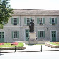
Hôtel de ville de Saint-Pons-de-Thomières
792 m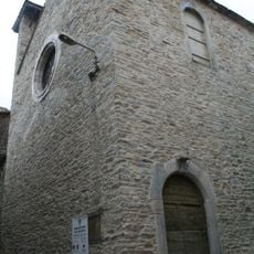
Chapelle des pénitents de Saint-Pons-de-Thomières
895 m
Palais épiscopal de Saint-Pons-de-Thomières
696 m
Le Saintponien
859 m
Wayside cross
554 m
Taloc
878 m
Vague
913 m
Piercing
826 m
La naissance de Venus
776 m
Métamorphose d'une goutte
844 m
Work of art, mural
794 m
Saint-Aulary
877 m
Chant Albigense
690 m
Stele, memorial
815 m
La Stèle des Harkis
833 m
Jumelage Navarcles Saint-Pons-de-Thomières
761 m
Memorial, commemorative plaque
777 m
La Stèle Charles Barthès
810 m
Memorial, commemorative plaque
764 m
Memorial, commemorative plaque
751 m
Memorial, commemorative plaque
730 m
Memorial, commemorative plaque
830 mVisited this place? Tap the stars to rate it and share your experience / photos with the community! Try now! You can cancel it anytime.
Discover hidden gems everywhere you go!
From secret cafés to breathtaking viewpoints, skip the crowded tourist spots and find places that match your style. Our app makes it easy with voice search, smart filtering, route optimization, and insider tips from travelers worldwide. Download now for the complete mobile experience.

A unique approach to discovering new places❞
— Le Figaro
All the places worth exploring❞
— France Info
A tailor-made excursion in just a few clicks❞
— 20 Minutes