Catholic church building, wayside cross
Location: Saint-Guilhem-le-Désert
GPS coordinates: 43.75119,3.51266
Latest update: November 15, 2025 04:58
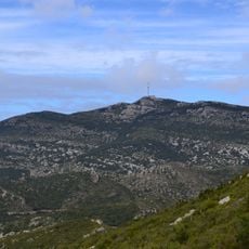
Mont Saint-Baudille
2.3 km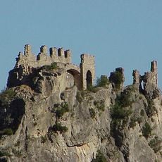
Château du Géant
3.5 km
Dolmen de Rigoule
3.4 km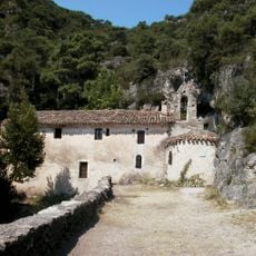
Chapelle Notre-Dame-de-Belle-Grâce de Saint-Guilhem-le-Désert
2.4 km
Mont Saint-Baudille - Seranne
2.3 km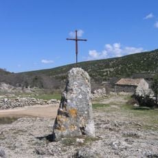
Menhir de la Mare des Lavagnes
3 km
Pioch de Roquebrune - Seranne
1.3 km
Pioch de la Boffia
3 km
Menhir du Mouton
2.8 km
Scenic viewpoint
3.4 km
Scenic viewpoint
2.3 km
Scenic viewpoint
2.6 km
Scenic viewpoint
2 km
Scenic viewpoint
1.2 km
Point de vue Max Nègre
2.2 km
Table d'orientation du Mont Saint-Baudille
2.4 km
Scenic viewpoint
3 km
Wayside cross
3.3 km
Scenic viewpoint
3.4 km
Ruins
3.3 km
Bench, wayside cross
3.4 km
Dolmen du Mas de Tourreau A
1.2 km
Menhir du Devois de la Trivalle
3 km
Dolmen du Mas de Tourreau B
1.2 km
Dolmen du Mas de Tourreau C
1.1 km
Menhir du Mas de Tourreau
1.2 km
Dolmen de la Bergerie d'Azirou
2.2 km
Wayside cross
3.4 kmReviews
Visited this place? Tap the stars to rate it and share your experience / photos with the community! Try now! You can cancel it anytime.
Discover hidden gems everywhere you go!
From secret cafés to breathtaking viewpoints, skip the crowded tourist spots and find places that match your style. Our app makes it easy with voice search, smart filtering, route optimization, and insider tips from travelers worldwide. Download now for the complete mobile experience.

A unique approach to discovering new places❞
— Le Figaro
All the places worth exploring❞
— France Info
A tailor-made excursion in just a few clicks❞
— 20 Minutes