Wayside cross, Catholic church building
Location: Laval-Atger
Location: Saint Bonnet-Laval
GPS coordinates: 44.79485,3.71789
Latest update: November 25, 2025 08:44
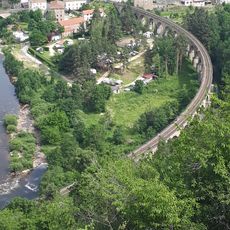
Viaduc de Chapeauroux
5.2 km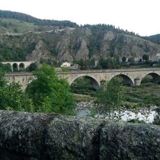
Condate
5.2 km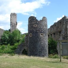
Château de Jonchères
5.7 km
Château de Condres
3.7 km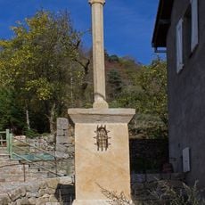
Croix de Briges
3.7 km
Croix de Laval-Atger
2.9 km
Église Saint-Privat de Laval-Atger
2.9 km
Croix de Saint-Bonnet-de-Montauroux
2.3 km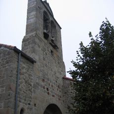
Église Saint-Julien de Fontanes
6.1 km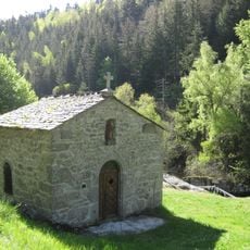
Chapelle Saint-Méen de Grandrieu
5.8 km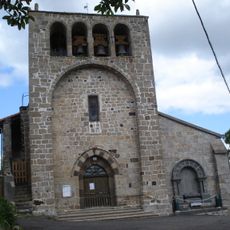
Rauret war memorial
6.4 km
Scenic viewpoint
5.7 km
Scenic viewpoint
2.8 km
Scenic viewpoint, bench
1 km
Point de vue sur le viaduc
5.4 km
Calvaire
5.8 km
Calvaire
6.3 km
Calvaire
6.4 km
Calvaire
5.3 km
Calvaire
5.3 km
Catholic church building, wayside cross
4.7 km
Wayside cross, Catholic church building
5.3 km
Wayside cross
6 km
Wayside cross
6.1 km
Wayside cross
4.1 km
Wayside cross
5.9 km
Wayside cross
6 km
Calvaire
4.6 kmVisited this place? Tap the stars to rate it and share your experience / photos with the community! Try now! You can cancel it anytime.
Discover hidden gems everywhere you go!
From secret cafés to breathtaking viewpoints, skip the crowded tourist spots and find places that match your style. Our app makes it easy with voice search, smart filtering, route optimization, and insider tips from travelers worldwide. Download now for the complete mobile experience.

A unique approach to discovering new places❞
— Le Figaro
All the places worth exploring❞
— France Info
A tailor-made excursion in just a few clicks❞
— 20 Minutes