Catholic church building, wayside cross
Location: Calvignac
Inception: January 1, 1748
GPS coordinates: 44.44046,1.79694
Latest update: November 20, 2025 00:08
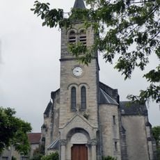
Église Saint-Jean-Porte-Latine de Saint-Jean-de-Laur
3.8 km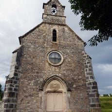
Église Saint-Julien de Seuzac
3.8 km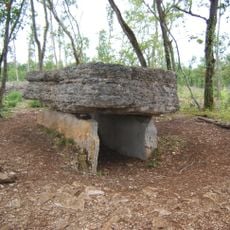
Dolmen d'Agranel
2.9 km
Scenic viewpoint
3.1 km
Scenic viewpoint
3.1 km
Scenic viewpoint
3.1 km
Scenic viewpoint
3.1 km
Memorial, war memorial
3.7 km
Dolmen Peyre Gages
1.6 km
Wayside cross
3.9 km
Wayside cross
3.3 km
Memorial, war memorial
3 km
Les 4 Routes
1.8 km
Aubiac
1.1 km
Scenic viewpoint
3 km
Dolmen du Bosc
2.9 km
Dolmen Bosc 2
2.9 km
Dolmen Puech Blanc
1.8 km
Scenic viewpoint
3.7 km
Tomb
3.1 km
Catholic church building, wayside cross
869 m
Catholic church building, wayside cross
931 m
Dolmen d'Aubiac (B)
1.3 km
Wayside cross
3.8 km
Wayside cross
3.8 km
Wayside cross
3.9 km
Wayside cross
3.8 km
Wayside cross
3.6 kmVisited this place? Tap the stars to rate it and share your experience / photos with the community! Try now! You can cancel it anytime.
Discover hidden gems everywhere you go!
From secret cafés to breathtaking viewpoints, skip the crowded tourist spots and find places that match your style. Our app makes it easy with voice search, smart filtering, route optimization, and insider tips from travelers worldwide. Download now for the complete mobile experience.

A unique approach to discovering new places❞
— Le Figaro
All the places worth exploring❞
— France Info
A tailor-made excursion in just a few clicks❞
— 20 Minutes