Wayside cross, Catholic church building
Location: Cazères-sur-l'Adour
GPS coordinates: 43.76009,-0.31525
Latest update: November 18, 2025 23:11
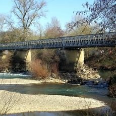
Pont métallique sur l'Adour
473 m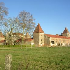
Abbaye Saint-Jean de la Castelle
2.1 km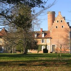
Château du Lau
4.3 km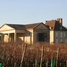
Château de Bachen
4.7 km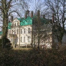
Château du Vignau
2.7 km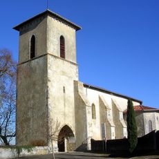
Église Saint-Pierre de Renung
3.5 km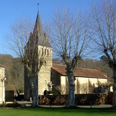
Église Saint-Leu de Duhort
4 km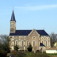
Église Notre-Dame de l'Assomption du Vignau
2.7 km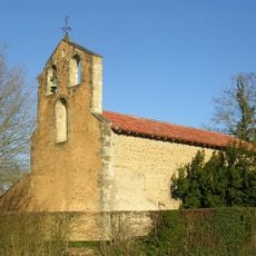
Église Sainte-Marie-Madeleine de Bachen
5 km
Église Saint-Sigismond de Bordères
4.2 km
Château du Souilh
4.4 km
Scenic viewpoint
2.4 km
Catholic church building, wayside cross
3 km
Wayside cross
189 m
Mural, Work of art
4 km
Monument aux Morts
162 m
Memorial
4.2 km
Wayside cross
532 m
Catholic church building, wayside cross
213 m
Catholic church building, wayside cross
2.1 km
Wayside cross
3.7 km
Wayside cross
5.7 km
Catholic church building, wayside cross
2.7 km
Memorial
2.7 km
Wayside cross, Catholic church building
2.9 km
Catholic church building, wayside cross
2.5 km
Wayside cross, Catholic church building
4.3 km
Catholic church building, wayside cross
173 mReviews
Visited this place? Tap the stars to rate it and share your experience / photos with the community! Try now! You can cancel it anytime.
Discover hidden gems everywhere you go!
From secret cafés to breathtaking viewpoints, skip the crowded tourist spots and find places that match your style. Our app makes it easy with voice search, smart filtering, route optimization, and insider tips from travelers worldwide. Download now for the complete mobile experience.

A unique approach to discovering new places❞
— Le Figaro
All the places worth exploring❞
— France Info
A tailor-made excursion in just a few clicks❞
— 20 Minutes