
High water mark, tourist attraction
Location: Chalonnes-sur-Loire
Inscription: CRUES 1916, 1936, DEC 1982, 6 M 45, 1940, 5 JUIN 1856
GPS coordinates: 47.35228,-0.75808
Latest update: November 15, 2025 08:21
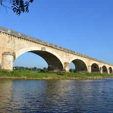
Pont de l'Alleud
3.1 km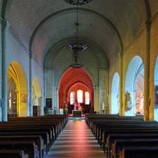
Église Saint-Maurille de Chalonnes
25 m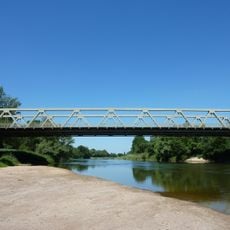
Pont de Cordez
1.3 km
Roc-en-Pail
1.2 km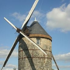
Moulin de la Roche
4.1 km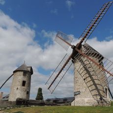
Moulins à vent d'Ardenay
3.3 km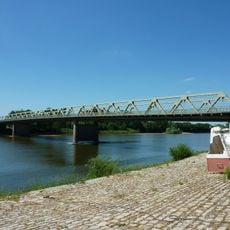
Pont sur le Grand Bras
1.8 km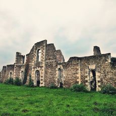
Le Désert
2.5 km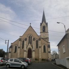
Église Notre-Dame de Chalonnes-sur-Loire
709 m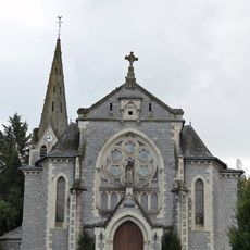
Église Saint-Pierre de Chaudefonds-sur-Layon
4.9 km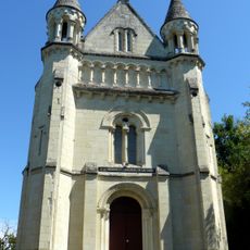
Chapelle Sainte-Barbe-des-Mines
3.7 km
Toposcope, scenic viewpoint
4.3 km
Scenic viewpoint
2.7 km
Scenic viewpoint
2.3 km
Scenic viewpoint
3.3 km
Le chevalement de Malécots
4.3 km
Chalonnes, confluence de la Loire et du Layon
223 m
Rocher de Rocampaille
2.1 km
Le Jeu
4 km
Petit Montaigu
2.5 km
Grand Montaigu
2.5 km
Catholic church building, wayside cross, Christianity
4.7 km
Christianity, Catholic church building, wayside cross
4.6 km
Croix des Quatre Routes
4.6 km
Information board, memorial
141 m
Memorial, commemorative plaque
3.7 km
Christianity, Catholic church building, wayside cross
557 m
Catholic church building, wayside cross, Christianity
3 kmReviews
Visited this place? Tap the stars to rate it and share your experience / photos with the community! Try now! You can cancel it anytime.
Discover hidden gems everywhere you go!
From secret cafés to breathtaking viewpoints, skip the crowded tourist spots and find places that match your style. Our app makes it easy with voice search, smart filtering, route optimization, and insider tips from travelers worldwide. Download now for the complete mobile experience.

A unique approach to discovering new places❞
— Le Figaro
All the places worth exploring❞
— France Info
A tailor-made excursion in just a few clicks❞
— 20 Minutes