Catholic church building, wayside cross
Location: Saint-Chély-d'Aubrac
Inscription: M 1844
GPS coordinates: 44.58255,2.92527
Latest update: November 20, 2025 01:34
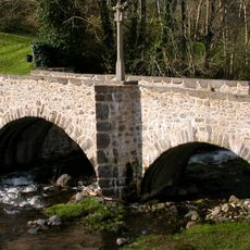
Pont des Pèlerins
767 m
Jardin botanique d'Aubrac
1 km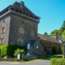
Tour de Bonnefon
1.9 km
Lavoir
788 m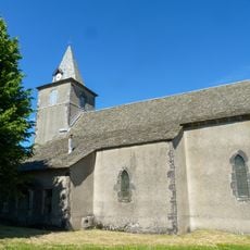
Église Sainte-Anne de Bonnefon
2 km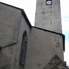
Saint Eligius Church in Saint-Chély-d'Aubrac
923 m
La Roque
4.8 km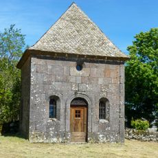
Chapelle Saint-Antoine de Bonnefon
2 km
Wayside cross
3.9 km
Wayside cross
5 km
Wayside cross
1.1 km
Wayside cross
2.2 km
Wayside cross
771 m
Wayside cross
1.8 km
Monument aux Morts
937 m
Château de Belvezet
3.1 km
Croix du Triadou
4.6 km
Vierge
1 km
Wayside cross
4.5 km
Wayside cross
3.7 km
Wayside cross
3.4 km
Wayside cross
5 km
Martinet
4 km
Plaque paroissiale du hameau de Bonnefon
1.9 km
Wayside cross
1.8 km
Waterfall
4 km
Cascade de Touzes
3.4 km
Waterfall
4.7 kmVisited this place? Tap the stars to rate it and share your experience / photos with the community! Try now! You can cancel it anytime.
Discover hidden gems everywhere you go!
From secret cafés to breathtaking viewpoints, skip the crowded tourist spots and find places that match your style. Our app makes it easy with voice search, smart filtering, route optimization, and insider tips from travelers worldwide. Download now for the complete mobile experience.

A unique approach to discovering new places❞
— Le Figaro
All the places worth exploring❞
— France Info
A tailor-made excursion in just a few clicks❞
— 20 Minutes