High water mark
Location: Yves
Inscription: Niveau d’inondation lors de la tempête Xynthia (2010)
GPS coordinates: 46.05670,-1.05775
Latest update: November 13, 2025 17:09
Casino of Châtelaillon-Plage
3.5 km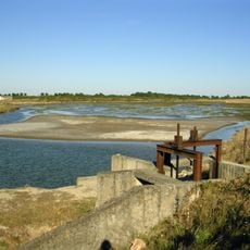
Réserve naturelle nationale du marais d'Yves
1.3 km
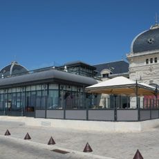
Market hall of Châtelaillon-Plage
3 km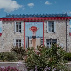
Chatelaillon-Plage Tourist Office
3.3 km
Beauséjour
3.7 km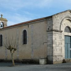
Église Saint-Étienne d'Yves
4.3 km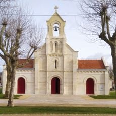
Église Sainte-Madeleine de Châtelaillon-Plage
2.9 km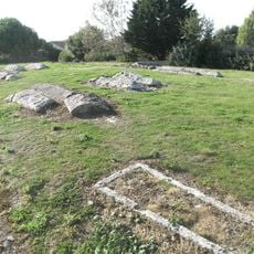
Nécropole
2.2 km
Work of art, sculpture
3.1 km
Work of art, sculpture
3.6 km
Yves
2 km
Yves - Le Bourg
4.5 km
Yves
2.7 km
Work of art, sculpture
2.9 km
Théâtre de Verdure
3.6 km
Work of art, sculpture
3.1 km
Statue, Work of art
3 km
Notre-Dame de Châtelaillon-Plage
2.9 km
Work of art, sculpture
1.8 km
Monument aux Morts
3.6 km
Wayside cross
2.6 km
Wayside cross
3 km
Monument aux Morts
2.6 km
Monument aux Morts
1.9 km
Wayside cross
2.7 km
Memorial, commemorative plaque
2 km
High water mark
1.7 km
Memorial
4.6 kmReviews
Visited this place? Tap the stars to rate it and share your experience / photos with the community! Try now! You can cancel it anytime.
Discover hidden gems everywhere you go!
From secret cafés to breathtaking viewpoints, skip the crowded tourist spots and find places that match your style. Our app makes it easy with voice search, smart filtering, route optimization, and insider tips from travelers worldwide. Download now for the complete mobile experience.

A unique approach to discovering new places❞
— Le Figaro
All the places worth exploring❞
— France Info
A tailor-made excursion in just a few clicks❞
— 20 Minutes