Wayside cross
Location: Saint-Avit-Rivière
GPS coordinates: 44.75889,0.90693
Latest update: November 13, 2025 15:17
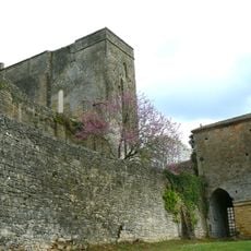
Château de Montferrand
3.4 km
Château de Regagnac
1.6 km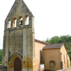
Église Saint-Avit (Saint-Avit-Rivière)
2 km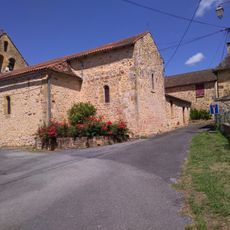
Église Saint-Pierre-ès-Liens de Bouillac
946 m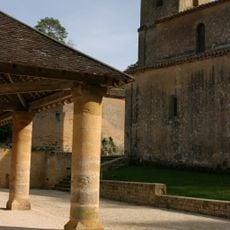
Nouvelle église Saint-Christophe de Montferrand-du-Périgord
3.4 km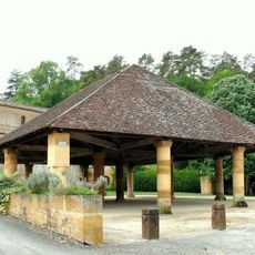
Halle couverte de Montferrand-du-Périgord
3.4 km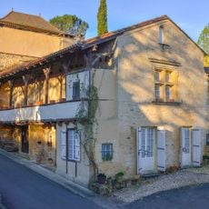
Maison du XVIe
3.4 km
Wayside cross
3.1 km
Wayside cross
3.8 km
Wayside cross
3.3 km
Wayside cross
3.5 km
Wayside cross
3.7 km
Wayside cross
2.4 km
Wayside cross
2.8 km
Château médiéval
3.5 km
Wayside cross
2.6 km
Wayside cross
1.7 km
Wayside cross
1.1 km
Wayside shrine
3.4 km
Wayside cross
3.3 km
Wayside cross
2.2 km
Wayside cross
3.4 km
Wayside cross
3.3 km
Wayside cross
3.3 km
Wayside cross
1.7 km
Catholic church building, wayside cross
885 m
Wayside cross, Catholic church building
1.6 km
Catholic church building, wayside cross
668 mReviews
Visited this place? Tap the stars to rate it and share your experience / photos with the community! Try now! You can cancel it anytime.
Discover hidden gems everywhere you go!
From secret cafés to breathtaking viewpoints, skip the crowded tourist spots and find places that match your style. Our app makes it easy with voice search, smart filtering, route optimization, and insider tips from travelers worldwide. Download now for the complete mobile experience.

A unique approach to discovering new places❞
— Le Figaro
All the places worth exploring❞
— France Info
A tailor-made excursion in just a few clicks❞
— 20 Minutes