Machine, tourist attraction
Location: Lüttringhausen
Location: Remscheid
GPS coordinates: 51.20117,7.21180
Latest update: November 24, 2025 06:37
Brodtberg
1.9 km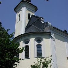
Heilig-Kreuz-Kirche
1.9 km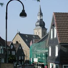
Protestant Church (Lüttringhausen)
1.8 km
Diepmannsbachtal und Seitenbäche
1.1 km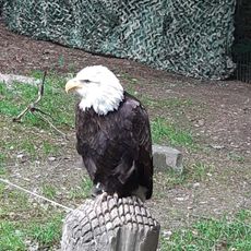
Falknerei Bergisch Land
1.4 km
Leyerbachtal
45 m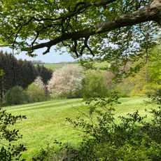
Farrenbracker Bachtal
892 m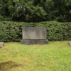
Jüdischer Friedhof Remscheid-Lüttringhausen
1.9 km
Tackermühle
1.5 km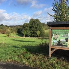
Oberer Teufelsbachtal
1.6 km
LSG-Remscheid-Gelpe
1 km
Oberes Teufelsbach
1.7 km
LSG-Hochflaechen Buscher Hof, Hohen Hagen und Westhausen
1.3 km
157
1.4 km
Memorial
1.6 km
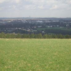
Scenic viewpoint
1.4 km
Scenic viewpoint
1.3 km
Scenic viewpoint
472 m
Scenic viewpoint
1.8 km
Memorial
1.6 km
Freilichtbühne Lüttringhausen
1.9 km
Person killed 1923 by french soldiers
971 m
Hilbertshammer
20 m
Ehrenmal
1.9 km
Memorial
1.9 km
Memorial stone, memorial
1.6 km
Memorial, commemorative plaque
1.4 km
Tourist attraction
25 mReviews
Visited this place? Tap the stars to rate it and share your experience / photos with the community! Try now! You can cancel it anytime.
Discover hidden gems everywhere you go!
From secret cafés to breathtaking viewpoints, skip the crowded tourist spots and find places that match your style. Our app makes it easy with voice search, smart filtering, route optimization, and insider tips from travelers worldwide. Download now for the complete mobile experience.

A unique approach to discovering new places❞
— Le Figaro
All the places worth exploring❞
— France Info
A tailor-made excursion in just a few clicks❞
— 20 Minutes