
Sevilleta National Wildlife Refuge
8.5 km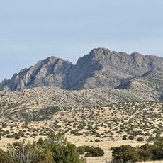
Ladron Peak
21.2 km
Array Operations Center
29.9 km
Ladd S. Gordon Waterfowl Complex
2.3 km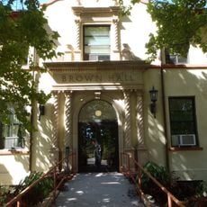
Brown Hall
30.3 km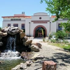
New Mexico Bureau of Geology Mineral Museum
30.1 km
Etscorn Observatory
29.6 km
EMRTC Rattlesnake
29.6 km
Passage of the Earth and the Sky
30.2 km
Sarracino Hall
15.4 km
Jean Macey Music Annex
30.1 km
"The Past", "The Present", and "The Future"
30.2 km
New Mexico Tech Entrance Sign
30 km
NMT Arranged Rocks
30.3 km
New Mexico Tech Golf Course
30 km
In Search of the Light
30 km
Nusenda Credit Union, Socorro Mural
29.7 km
Bell
20.2 km
Dust Bowl Home Historic Site
26.3 km
Scenic viewpoint
26 km
San Lorenzo Ridge Overlook
14.8 km
San Lorenzo Ridge Overlook
14.7 km
Waterfall
30.1 km
Waterfall
30.1 km
Waterfall
30.1 km
Waterfall
30.1 km
Waterfall
30.1 km
Waterfall
2.6 kmReviews
Visited this place? Tap the stars to rate it and share your experience / photos with the community! Try now! You can cancel it anytime.
Discover hidden gems everywhere you go!
From secret cafés to breathtaking viewpoints, skip the crowded tourist spots and find places that match your style. Our app makes it easy with voice search, smart filtering, route optimization, and insider tips from travelers worldwide. Download now for the complete mobile experience.

A unique approach to discovering new places❞
— Le Figaro
All the places worth exploring❞
— France Info
A tailor-made excursion in just a few clicks❞
— 20 Minutes