
Cannon
Location: Hartlepool
Website: https://www.geograph.org.uk/photo/1608584
Website: https://geograph.org.uk/photo/1608584
GPS coordinates: 54.70094,-1.18352
Latest update: November 16, 2025 19:10

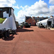
Heugh Battery
612 m
St Hilda's Church
627 m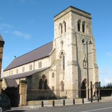
Church of St Mary
524 m
Borough Buildings and Borough Hall
526 m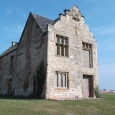
North East Wing Of St Hilda's Hospital
538 m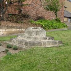
Remains Of Wayside Cross
600 m
36 And 36A, Town Wall
649 m
Water Pump Approximately 14 Metres To South West Of Number 101
632 m
Number 3 And Adjoining Wall
634 m
33, Town Wall
644 m
62, Southgate
613 m
United Reformed Church
285 m
Boundary Wall Railings And Gate Enclosing South East And West Sides Of Number 62
624 m
Carnegie Building And No. 72
380 m
Mayfield House
434 m
27 And 29, Middlegate
557 m
Moor House
435 m
34, Town Wall
647 m
Union House
585 m
Victoria Buildings And 2 Middlegate
557 m
Headland Museum
401 m
Mural, Work of art
532 m
Mural, Work of art
590 m
Work of art, sculpture
259 m
Graffiti, Work of art
476 m
Scenic viewpoint
20 m
Cannon
585 m
Cannon
587 mReviews
Visited this place? Tap the stars to rate it and share your experience / photos with the community! Try now! You can cancel it anytime.
Discover hidden gems everywhere you go!
From secret cafés to breathtaking viewpoints, skip the crowded tourist spots and find places that match your style. Our app makes it easy with voice search, smart filtering, route optimization, and insider tips from travelers worldwide. Download now for the complete mobile experience.

A unique approach to discovering new places❞
— Le Figaro
All the places worth exploring❞
— France Info
A tailor-made excursion in just a few clicks❞
— 20 Minutes