
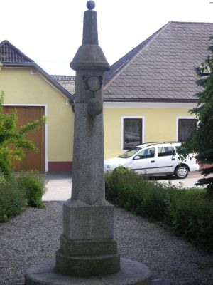
Zur Geschichte des Prangers: siehe url
Location: Grafenschlag
Inception: January 1, 1894
Website: https://zcrux.zwalk.at/pranger-48-500558-15-166945
GPS coordinates: 48.50051,15.16695
Latest update: November 12, 2025 18:05
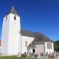
Pfarrkirche hl. Martin, Grafenschlag
88 m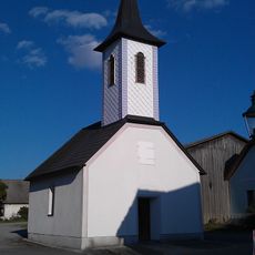
Ortskapelle Kleinnondorf
1.6 km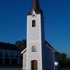
Ortskapelle Kaltenbrunn
1.8 km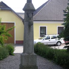
Pranger
5 m
Footbridge
2.2 km
Fußgängerbrücke
2.2 km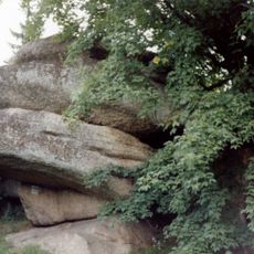
Rock formations in Grafenschlag
2.6 km
Wayside cross
1.4 km
Wayside shrine, Christianity
1.6 km
Trauner Marterl
1.8 km
Wayside cross
2.6 km
Wayside cross
2 km
Wayside cross
2.2 km
Wayside cross
1 km
Kriegerdenkmal
56 m
Wayside cross
1.2 km
Wayside shrine
2.1 km
Wayside cross
1.2 km
Rotes Kreuz
869 m
Wayside shrine, Christianity
2.5 km
Wayside shrine
2 km
Tree, wayside shrine
2 km
Wayside cross
1.9 km
Wayside shrine, Christianity
2.2 km
Wayside cross
2.6 km
Hubertus Marterl
1 km
Christianity, wayside shrine
1.2 km
Tree, wayside shrine
2.4 kmReviews
Visited this place? Tap the stars to rate it and share your experience / photos with the community! Try now! You can cancel it anytime.
Discover hidden gems everywhere you go!
From secret cafés to breathtaking viewpoints, skip the crowded tourist spots and find places that match your style. Our app makes it easy with voice search, smart filtering, route optimization, and insider tips from travelers worldwide. Download now for the complete mobile experience.

A unique approach to discovering new places❞
— Le Figaro
All the places worth exploring❞
— France Info
A tailor-made excursion in just a few clicks❞
— 20 Minutes