Chest opened
+${chestReward.xp} XP
Explorer
NOUVEAU ×${chestReward.collectible.quantity}
tapez pour fermer

See the monuments around you in AR Open chests in the app

Around Us is built for your phone — point your camera at the streets and discover the monuments and places around you in augmented reality. Around Us is built for your phone — chests unlock when you walk, explore and capture nearby places.

•

Enable Location

We need your location to show you interesting places around you

Discover nearby places

Find interesting locations and hidden gems around you

Precise directions

Get accurate directions and distances to places

Your location is never shared with other users. It's only used when you tap the location button.

Jelení hora

Log in to your account

Start exploring — it's free

Trusted by 92,894 travelers worldwide

Continue with Google
Continue with Apple
or

We will send you a code to connect

By continuing, you accept our Terms and Conditions and our Privacy Policy

Check your inbox

We've sent a pincode in your inbox. Please enter the code below.

Jelení hora

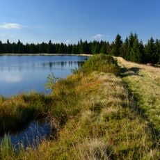
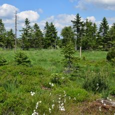
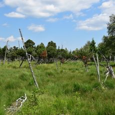
Jelení hora, Mountain summit in northern Bohemia, Czech Republic.

Hassberg (Czech: Jelení hora) is a 993 m nefelinite hill in the Ore Mountains, the highest point of the Přísečnická hornatina. Its summit is a slightly sloping lava plateau with steep slopes, and a concrete-clad stone pillar marks the geodetic point at 993.71 m. About 250 m northwest of the top, six-sided nefelinite columns up to 30 cm wide and 4–5 m high tilt 45° to the southeast.

Countess Gabriela Buquoy had a wooden viewing hut with a rooftop platform and a stair built on the summit in the 1830s; it was renewed in 1852 and demolished at the end of the 1880s. A report of 1924 mentions a wooden pyramid on the highest point, and in 1928 an 18-metre observation pyramid was erected there. A castle, the Haßburg, is said to have stood on the mountain and has completely vanished.

The Czech name Jelení hora means "Deer Mountain", while the German name Hassberg refers to a castle, the Haßburg, that is said to have stood on the slope and has completely disappeared. The yellow-marked trail from the red Nová Ves–Měděnec route leads directly to the summit.

The summit is reachable via marked forest trails with the main route starting from nearby villages. Good footwear and basic navigation skills are helpful for a safe visit.

The summit's 994 m figure refers to a concrete-clad stone survey pillar standing well above the ground; the actual summit plateau is 993 m. The column marks a geodetic point on the flattened top of a Tertiary nephelinite lava flow.

The community of curious travelers

AroundUs brings together thousands of curated places, local tips, and hidden gems, enriched daily by 92,894 contributors worldwide.

Start exploring
GPS coordinates
50.49035,13.15856
Latest update
October 21, 2026 18:21
Around this place
Pressnitz Valley Railway
Germany

Pressnitz Valley Railway

3 mi
Prameniště Chomutovky
Czech Republic

Prameniště Chomutovky

2.5 mi
Švédská lípa
Czech Republic

Švédská lípa

2.5 mi
Na Loučkách II
Czech Republic

Na Loučkách II

2.4 mi
Na Loučkách
Czech Republic

Na Loučkách

2.9 mi
Schwarze Heide - Kriegswiese
Germany

Schwarze Heide - Kriegswiese

1.5 mi
Novodomské rašeliniště – Kovářská
Czech Republic

Novodomské rašeliniště – Kovářská

2.1 mi
Přísečnická hornatina
Czech Republic

Přísečnická hornatina

1.5 mi
Church of Saint Nicholas
Czech Republic

Church of Saint Nicholas

2.3 mi
Church of Saint Christopher
Czech Republic

Church of Saint Christopher

1.4 mi
Kostel Panny Marie
Czech Republic

Kostel Panny Marie

2.2 mi
Bahnhof Jöhstadt
Germany

Bahnhof Jöhstadt

2.9 mi
Pomník na památku zaniklého města Přísečnice
Czech Republic

Pomník na památku zaniklého města Přísečnice

2.5 mi
Socha Panny Marie
Czech Republic

Socha Panny Marie

2.5 mi
Socha Madony na rozcestí silnic západně od jezera Přísečnice
Czech Republic

Socha Madony na rozcestí silnic západně od jezera Přísečnice

2.5 mi
Bahnhof Jöhstadt
Germany

Bahnhof Jöhstadt

2.9 mi
St.-Salvator-Kirche
Germany

St.-Salvator-Kirche

3.2 mi
Na loučkách
Czech Republic

Na loučkách

2.4 mi
Kirche (mit Ausstattung), Kirchhof mit Leichenhalle, Einfriedungsmauer und Kriegerdenkmale für die Gefallenen des deutsch-französischen Krieges und die Gefallenen des 1. Weltkrieges auf dem Kirchhof Satzunger Kirchstraße 1
Germany

Kirche (mit Ausstattung), Kirchhof mit Leichenhalle, Einfriedungsmauer und Kriegerdenkmale für die Gefallenen des deutsch-französischen Krieges und die Gefallenen des 1. Weltkrieges auf dem Kirchhof Satzunger Kirchstraße 1

3 mi
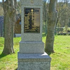
World War I memorial
Czech Republic

World War I memorial

1.3 mi
Plastika Křídla racků u přehradní hráze nádrže Přísečnice
Czech Republic

Plastika Křídla racků u přehradní hráze nádrže Přísečnice

1.3 mi
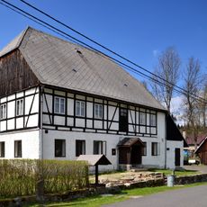
Usedlost čp. 7
Czech Republic

Usedlost čp. 7

1.2 mi
Pomník padlým v Rusové
Czech Republic

Pomník padlým v Rusové

2.6 mi
Železniční most přes silnici II/223 v Rusové
Czech Republic

Železniční most přes silnici II/223 v Rusové

2.7 mi
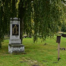
Pomník padlým v 1. světové válce v Kryštofových Hamrech
Czech Republic

Pomník padlým v 1. světové válce v Kryštofových Hamrech

1.3 mi
Kříž u silnice západně od jezera Přísečnice
Czech Republic

Kříž u silnice západně od jezera Přísečnice

2.5 mi
Hammerherrenhaus Schmalzgrube
Germany

Hammerherrenhaus Schmalzgrube

2.6 mi
Železniční most přes silnici II/224 v Rusové
Czech Republic

Železniční most přes silnici II/224 v Rusové

2.9 mi
Show the full map
Reviews
Share your experience

No review yet

Discussions
Start a discussion...

No discussion yet

« Jelení hora - Mountain summit in northern Bohemia, Czech Republic » is provided by Around Us (aroundus.com). Images and texts are derived from Wikimedia project under a Creative Commons license. You are allowed to copy, distribute, and modify copies of this page, under the conditions set by the license, as long as this note is clearly visible.

Discover hidden gems everywhere you go!

From secret cafés to breathtaking viewpoints, skip the crowded tourist spots and find places that match your style. Our app makes it easy with voice search, smart filtering, route optimization, and insider tips from travelers worldwide. Download now for the complete mobile experience.

Around Us App Screenshot
❝

A unique approach to discovering new places❞

— Le Figaro

❝

All the places worth exploring❞

— France Info

❝

A tailor-made excursion in just a few clicks❞

— 20 Minutes

Around Us
Travel Guide & Maps
Download

Send to your phone

QR Code
1

Open the camera app on your mobile.

2

Point at the QR code with your camera. A notification will appear.

3

Tap the notification to open the link.