Lunahuaná District, Administrative district in Cañete Province, Peru
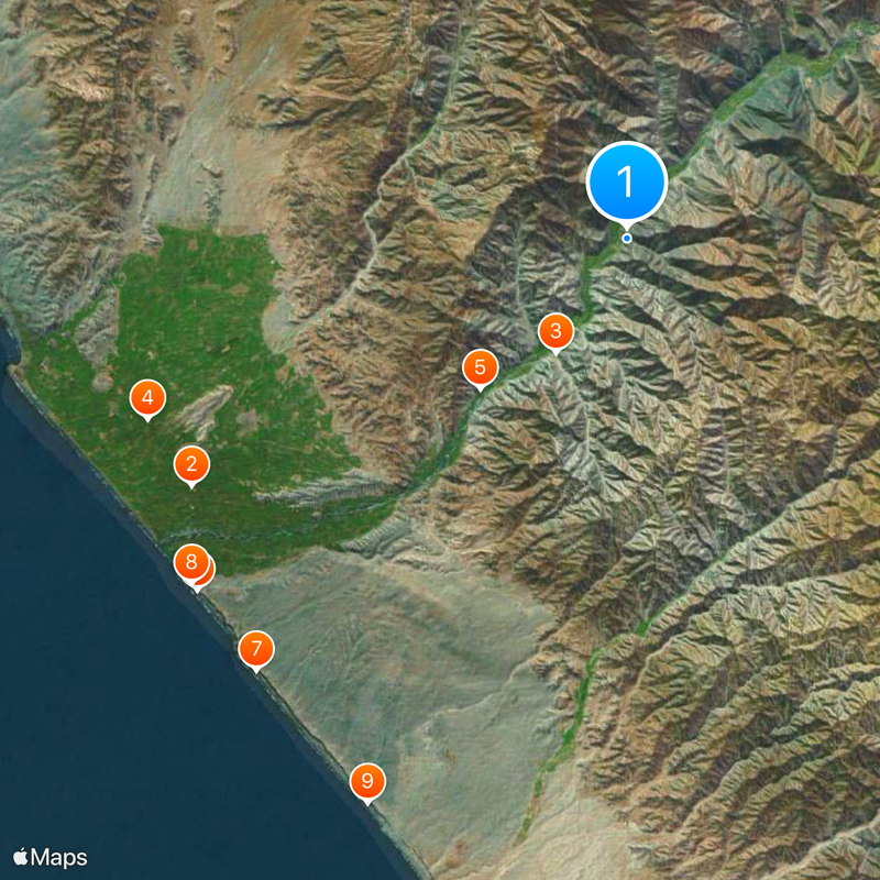
Lunahuaná District is an area in Cañete Province centered along the Cañete River, containing several populated communities scattered across a river valley. These settlements sit within a landscape of hills and agricultural terraces that slope toward the flowing water.
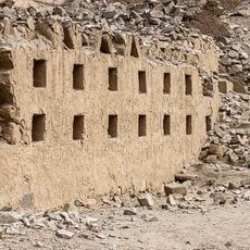
The district was officially established in 1821 following Peru's independence, though the area had been occupied for centuries. An ancient Inka fortress called Inka Wasi once stood here, representing earlier periods of regional control.
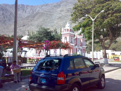
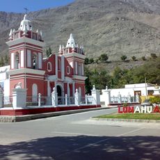
The central plaza hosts a church built by Franciscans that remains the heart of community gatherings and celebrations. Local traditions and religious festivals centered here shape how residents experience their town throughout the year.
The district is accessible by road from Lima, making it reachable for a day trip or longer stay with several lodging options. The riverside location offers water-based activities and outdoor exploration best enjoyed during the drier months.
The region is home to five wineries producing pisco, a traditional Peruvian grape spirit with centuries of history. One winery dates back to the late 1800s, showing how deeply spirit production has shaped the local landscape and economy.
Location: Cañete Province
Capital city: Lunahuaná
Elevation above the sea: 479 m
Shares border with: Pacarán District, Chavín District, San Vicente de Cañete District, Nuevo Imperial District
Website: http://munilunahuana.gob.pe
GPS coordinates: -12.96000,-76.13444
Latest update: December 6, 2025 22:02
Pachacamac
114.1 km
Paracas Candelabra
94.8 km
Nor Yauyos-Cochas Landscape Reserve
107.1 km
Palacio Unanue
31.1 km
Tambo Colorado
89.3 km
Inka Wasi
8.3 km
Pariacaca
108.8 km
Pachacamac site Museum
114.9 km
Lake Choclococha
118.1 km
La Centinela
54.7 km
Inka Wasi, Huancavelica
117.7 km
Hacienda San José
62.4 km
Pueblo Antiguo de Huaquis
82.9 km
National Museum of Archaeology, Peru
115.3 km
Iglesia de San Juan Bautista, Huaytara
110.9 km
Sima Pumacocha
78.9 km
Huaycán de Cieneguilla
119.4 km
Ticlla
80.1 km
Omas River
51.2 km
National Museum of Peru
115.2 km
Wamp'una
77.5 km
Llongote
73.1 km
Sukullu
83.9 km
Huayna Cotoni
78.8 km
Iglesia de Lunahuana
666 m
Iglesia de Nuestra Señora de la Asunción de Chilca
81.9 km
Iglesia de Calango
65.6 km
Iglesia del Espíritu Santo de Huamansica o Antioquía
106.1 kmReviews
Visited this place? Tap the stars to rate it and share your experience / photos with the community! Try now! You can cancel it anytime.
Discover hidden gems everywhere you go!
From secret cafés to breathtaking viewpoints, skip the crowded tourist spots and find places that match your style. Our app makes it easy with voice search, smart filtering, route optimization, and insider tips from travelers worldwide. Download now for the complete mobile experience.
A unique approach to discovering new places❞
— Le Figaro
All the places worth exploring❞
— France Info
A tailor-made excursion in just a few clicks❞
— 20 Minutes