Chest opened
+${chestReward.xp} XP
Explorer
NOUVEAU ×${chestReward.collectible.quantity}
tapez pour fermer

See the monuments around you in AR Open chests in the app

Around Us is built for your phone — point your camera at the streets and discover the monuments and places around you in augmented reality. Around Us is built for your phone — chests unlock when you walk, explore and capture nearby places.

•

Enable Location

We need your location to show you interesting places around you

Discover nearby places

Find interesting locations and hidden gems around you

Precise directions

Get accurate directions and distances to places

Your location is never shared with other users. It's only used when you tap the location button.

Cordillera del Cóndor

Log in to your account

Start exploring — it's free

Trusted by 92,935 travelers worldwide

Continue with Google
Continue with Apple
or

We will send you a code to connect

By continuing, you accept our Terms and Conditions and our Privacy Policy

Check your inbox

We've sent a pincode in your inbox. Please enter the code below.

Cordillera del Cóndor

Cordillera del Cóndor, Mountain range between Ecuador and Peru.

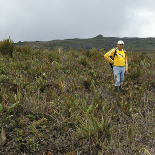
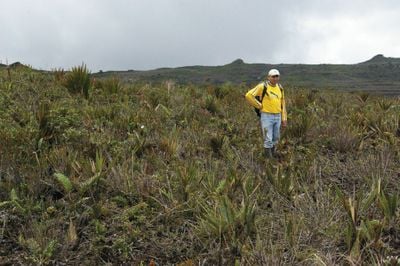
The Cordillera del Cóndor is a mountain range forming the border between Ecuador and Peru, stretching across several hundred kilometers. The region features steep forest-covered slopes, deep valleys, and plateaus that create diverse zones from cloud forest to higher elevations.

Border disputes over this mountain range between Ecuador and Peru resulted in armed conflicts spanning several decades, with tensions culminating in military encounters during the 1990s. A peace agreement in 1998 finally resolved the territorial disagreement and established a clear boundary.

Shuar communities live throughout the mountains following customs passed down through generations, using forest resources in ways adapted to the steep terrain. Their villages are scattered across valleys where family groups maintain connections to the land they have always known.

The range lies on the Ecuador–Peru border, with the Peruvian side partly inside Ichigkat Muja-Cordillera del Cóndor National Park, created in 2007. The Peruvian slopes drain the Santiago and Cenepa rivers. Botanical work resumed only after the 1998 peace treaty; the 2000 expeditions, backed by the Missouri Botanical Garden and the Shuar Federation, reached the Coangos basin. Mining concessions and the Mirador copper mine, in production since 2019, restrict access in places.

In 1993 Alwyn Gentry and colleagues reached the high sandstone ridges by helicopter supplied by the Ecuadorian Army, making the first plant collections in the bromeliad prairies. After the January 1995 conflict, biological exploration became impossible until José Manzanares and Eduardo Cueva made a short visit in May 1998 to collect Bromeliaceae.

The community of curious travelers

AroundUs brings together thousands of curated places, local tips, and hidden gems, enriched daily by 92,935 contributors worldwide.
Start exploring
Elevation above the sea
2,950 m
Length
150 km
GPS coordinates
-4.00000,-78.50000
Latest update
October 24, 2026 11:45
Reviews
Share your experience

No review yet

Discussions
Start a discussion...

No discussion yet

« Cordillera del Cóndor - Mountain range between Ecuador and Peru » is provided by Around Us (aroundus.com). Images and texts are derived from Wikimedia project under a Creative Commons license. You are allowed to copy, distribute, and modify copies of this page, under the conditions set by the license, as long as this note is clearly visible.

Discover hidden gems everywhere you go!

From secret cafés to breathtaking viewpoints, skip the crowded tourist spots and find places that match your style. Our app makes it easy with voice search, smart filtering, route optimization, and insider tips from travelers worldwide. Download now for the complete mobile experience.

Around Us App Screenshot
❝

A unique approach to discovering new places❞

— Le Figaro

❝

All the places worth exploring❞

— France Info

❝

A tailor-made excursion in just a few clicks❞

— 20 Minutes

Around Us
Travel Guide & Maps
Download

Send to your phone

QR Code
1

Open the camera app on your mobile.

2

Point at the QR code with your camera. A notification will appear.

3

Tap the notification to open the link.
