Enable Location

We need your location to show you interesting places around you

Discover nearby places

Find interesting locations and hidden gems around you

Precise directions

Get accurate directions and distances to places

Your location is never shared with other users. It's only used when you tap the location button.

Ol Doinyo Lengai

Log in to your account

Start exploring — it's free

Trusted by 62,615 travelers worldwide

Continue with Google
Continue with Apple
or

We will send you a code to connect

By continuing, you accept our Terms and Conditions and our Privacy Policy

Check your inbox

We've sent a pincode in your inbox. Please enter the code below.

Ol Doinyo Lengai

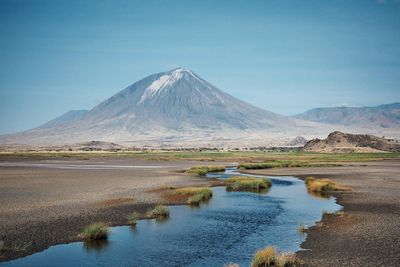
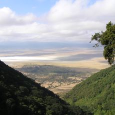
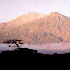
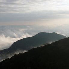
Ol Doinyo Lengai, Active volcano in Ngorongoro District, Tanzania.

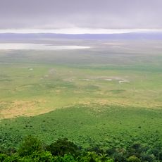
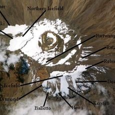
Ol Doinyo Lengai is an active volcano made from carbonatite in the Ngorongoro District of Tanzania. The summit at 2,960 meters (9,711 feet) shows two craters, with the northern one regularly ejecting lava.

Scientists reached the summit between 1904 and 1915 and began studying the rare rocks. Later geologists discovered that the lava composition differs markedly from other volcanoes around the world.

The Maasai and Sonjo call this peak the Mountain of God and use it as a site for prayer and religious ceremonies. Many locals consider the slopes and summit area sacred and come here to speak with ancestors or to ask for rain.

Climbing requires a permit and a guide, as the terrain is steep and has no marked trails. Most ascents begin at night so you reach the crater at dawn and avoid the heat.

The lava here is made of natrocarbonatite and flows at around 540 degrees Celsius (1,004 degrees Fahrenheit). It appears black at first and quickly turns white when exposed to moisture, a phenomenon seen nowhere else on Earth.

The community of curious travelers

AroundUs brings together thousands of curated places, local tips, and hidden gems, enriched daily by 60,000 contributors worldwide.

Start exploring
Elevation above the sea
2,960 m
Made from material
carbonatite
GPS coordinates
-2.75955,35.91409
Latest update
December 14, 2025 21:10
Photography locations in Tanzania

Tanzania provides photographers with an extraordinary range of subjects, from the Serengeti plains to Zanzibar's coastline and Mount Kilimanjaro, the highest peak in Africa at 19,341 feet (5,895 meters). The country contains major wildlife reserves including Tarangire, where elephant herds move...

« Ol Doinyo Lengai - Active volcano in Ngorongoro District, Tanzania » is provided by Around Us (aroundus.com). Images and texts are derived from Wikimedia project under a Creative Commons license. You are allowed to copy, distribute, and modify copies of this page, under the conditions set by the license, as long as this note is clearly visible.

Discover hidden gems everywhere you go!

From secret cafés to breathtaking viewpoints, skip the crowded tourist spots and find places that match your style. Our app makes it easy with voice search, smart filtering, route optimization, and insider tips from travelers worldwide. Download now for the complete mobile experience.

Around Us App Screenshot

A unique approach to discovering new places

Le Figaro

All the places worth exploring

France Info

A tailor-made excursion in just a few clicks

20 Minutes

Around Us
Travel Guide & Maps
Download

Send to your phone

QR Code
1

Open the camera app on your mobile.

2

Point at the QR code with your camera. A notification will appear.

3

Tap the notification to open the link.