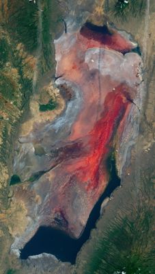
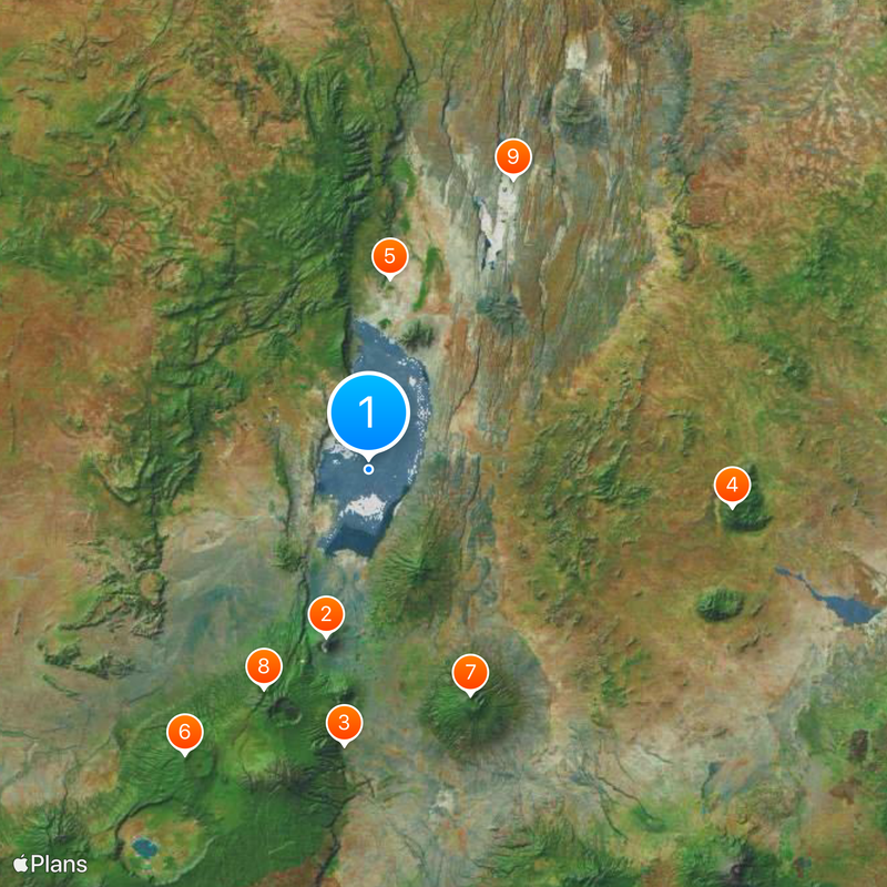
Lake Natron, Alkaline lake in northern Tanzania
Description
Spanning 35 miles (57 kilometers) in length, the waters display deep red hues created by salt-tolerant microorganisms and accumulated mineral deposits from surrounding volcanic terrain.
History
Over thousands of years, ongoing evaporation combined with limited water outflow transformed this body from a freshwater system into a shallow alkaline basin within the East African Rift Valley.
Culture
The area provides habitat for Maasai communities who have maintained their traditional herding routes along the shoreline for generations and offer visitors insight into their way of life.
Practical
Access works best between June and November when dirt roads remain passable and water levels drop, revealing flamingo nesting sites along the southern shoreline near Engare Sero village.
Did you know?
Over one million lesser flamingos depend on these waters as their primary global breeding ground, with the extreme alkalinity deterring predators from reaching nesting areas on salt crusts.
AroundUs brings together thousands of curated places, local tips, and hidden gems, enriched daily by 60,000 contributors worldwide. Discover all places nearby (Ngorongoro).
Earth displays its color range at numerous sites, from geological formations to human-built environments. The selection includes locations on six continents, where natural processes or cultural traditions have resulted in prominent visual displays. The Danxia mountains in China's Gansu province show...
Earth presents numerous geological formations, natural phenomena, and architectural structures that stand out through their exceptional characteristics. This collection documents such sites across all continents: the Darvaza Gas Crater in Turkmenistan, burning for decades; the luminescent glowworms...
Ol Doinyo Lengai
39.3 kmEngaruka
63.3 km
Ol Doinyo Orok
83.9 kmShompole Conservancy
44.2 km
Kitumbeine Volcano
56.6 kmJaeger Summit
55.6 kmNeedle Rock
74.7 kmMukao
64.3 kmCenter of Juu & Irendeni & Oldonelengia
61.8 kmGelai Bomba
37.4 kmTrail to Empaakaai Lake
57 kmAmmodump @ Kwenia
93.9 kmPre-historic Footprints
22.6 kmMukao
64.2 kmWaterfall
29 kmLoita Hills
64.5 kmLoita Hills
65.4 kmBeacon & Tree
64.6 kmNatron - Selela Rd Junction
39.3 kmKitumbein Viewpoint
75.5 kmThe way to second Boma
77.9 kmBoundary of Engaruka
81.7 kmFlamingos Viewpoint
22.5 kmCattle
65 kmWaterfall
92 kmWaterfall
49.2 kmOlmoti Waterfall
76.4 kmNg'abolo Waterfall
49.4 kmDiscover hidden gems everywhere you go!
From secret cafés to breathtaking viewpoints, skip the crowded tourist spots and find places that match your style. Our app makes it easy with voice search, smart filtering, route optimization, and insider tips from travelers worldwide. Download now for the complete mobile experience.
A unique approach to discovering new places❞
— Le Figaro
All the places worth exploring❞
— France Info
A tailor-made excursion in just a few clicks❞
— 20 Minutes