Kirinyaga County, Administrative division at Mount Kenya foothills, Kenya
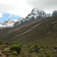
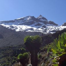
Kirinyaga County is an administrative division in Kenya located at the foothills of Mount Kenya, blending agricultural land with the northern section of Mount Kenya National Park. The area extends across different ecological zones that descend from the mountain to lower regions.
The area became an independent administrative division in 1963 when it separated from Embu District following Kenya's independence from Britain. This reorganization reflected the reshaping of administrative boundaries after independence was achieved.
The Kikuyu people maintain traditional practices through community gatherings, where they perform ceremonies and share agricultural knowledge across generations.
The main A2 highway connects several towns throughout the county and provides direct access to commercial routes and transport between different regions. Visitors should expect varying terrain conditions as the area ranges from mountain elevation to lower zones.
The county supplies water to over two million people through streams fed by melting glaciers on Mount Kenya. These water resources sustain communities across a wide geographic area beyond the county itself.
The community of curious travelers
AroundUs brings together thousands of curated places, local tips, and hidden gems, enriched daily by 60,000 contributors worldwide.