Northam State School, heritage listed building in Northam, Western Australia
Location: Shire of Northam
GPS coordinates: -31.65192,116.67510
Latest update: November 20, 2025 10:31
Northam Post Office
578 m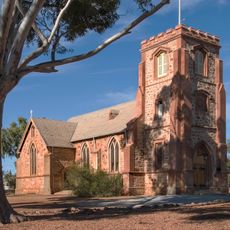
St John's Anglican Church & Parish Hall, Northam
144 m
Enright Park
663 m
Northam Post Office (former)
63 m
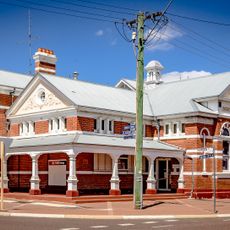
Shamrock Hotel
200 m
Uniting Church & Hall, Northam
641 m
Police Station
836 m
Northam Courthouse
783 m
Uralia
833 m
Northam Weir
616 m
Northam Fire Station No 2 & Quarters
501 m
Mitchell House
155 m
Fermoy House, Northam
717 m
Curdnatta
1 km
Commonwealth Bank, Northam
398 m
Northam Police Station
792 m
Northam Police Station and Court House
792 m
Byfield House
678 m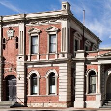
Northam Town Hall/Lesser Hall
579 m
Town Council Offices & Library, Northam
788 m
Bank of New South Wales (NSW), Northam
344 m
Old Methodist Church & Hall
641 m
ANZ Bank, Northam
200 m
National Australia Bank, Northam
255 m
Aerial Playground
571 m
Work of art, mural
900 m
Work of art, mural
558 m
Avon Descent Start Line
353 mReviews
Visited this place? Tap the stars to rate it and share your experience / photos with the community! Try now! You can cancel it anytime.
Discover hidden gems everywhere you go!
From secret cafés to breathtaking viewpoints, skip the crowded tourist spots and find places that match your style. Our app makes it easy with voice search, smart filtering, route optimization, and insider tips from travelers worldwide. Download now for the complete mobile experience.

A unique approach to discovering new places❞
— Le Figaro
All the places worth exploring❞
— France Info
A tailor-made excursion in just a few clicks❞
— 20 Minutes