Denial Bay, town in South Australia
Location: The District Council of Ceduna
GPS coordinates: -32.11575,133.55244
Latest update: October 27, 2025 07:54
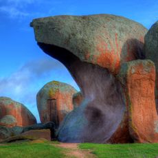
Murphys Haystacks
133.4 km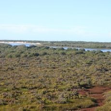
Acraman Creek Conservation Park
59.8 km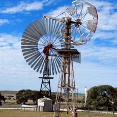
Penong Windmill Museum
55.4 km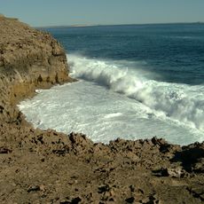
Whistling Hill
85.1 km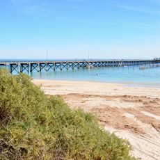
Smoky Bay Jetty
46.3 km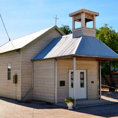
Smoky Bay Community Church
46.3 km
Lake
76.4 km
Scenic viewpoint
93 km
Natural Bridge
98.7 km
Cohen School SIte
68.7 km
Minions
84 km
Eyre Waterhole
101.8 km
Ceduna Radio Observatory
36.8 km
Ocean to Outback Gallery
2.7 km
Rock Hole
64.5 km
Scenic viewpoint
9.1 km
Scenic viewpoint
10.2 km
Tribute Tree
127 km
Murphys Haystacks
133.4 km
Murphys Haystacks
133.2 km
Scenic viewpoint
53.4 km
Googs Track Engineer/Surveyor
70.7 km
Googs Memorial
70.7 km
Edward John Eyre
101.7 km
Memorial, war memorial
98 km
Memorial
127 km
Monument
3.6 km
Monument
42.3 kmReviews
Visited this place? Tap the stars to rate it and share your experience / photos with the community! Try now! You can cancel it anytime.
Discover hidden gems everywhere you go!
From secret cafés to breathtaking viewpoints, skip the crowded tourist spots and find places that match your style. Our app makes it easy with voice search, smart filtering, route optimization, and insider tips from travelers worldwide. Download now for the complete mobile experience.

A unique approach to discovering new places❞
— Le Figaro
All the places worth exploring❞
— France Info
A tailor-made excursion in just a few clicks❞
— 20 Minutes