
Armero, Memorial town in Tolima Department, Colombia
Armero is a partially destroyed town in Tolima Department situated at about 285 meters elevation, surrounded by mountains and volcanic formations of the Andes. The site spreads across a valley where the remains of the original settlement are still partly visible beneath volcanic deposits.
The town was founded in 1895 and grew into a center of cotton production in the region. The eruption of Nevado del Ruiz volcano in 1985 destroyed it completely and caused one of South America's worst natural disasters.
The Memory Interpretation Center holds photographs, documents, and personal objects that preserve the stories of those who died. Visitors experience how the community honors what happened and what this place means to the survivors and their families.
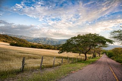
The site is accessible by paved roads from Ibagué or Honda, with an information center on-site to help visitors navigate. Guided tours are available throughout the week to help you understand the site and its history.
Buried beneath the volcanic deposits are the remains of roughly 5000 buildings that today function like an underground archive of natural power. Some parts of the original city layout are still recognizable and offer visitors an unusual glimpse into a lost way of life.
Location: Tolima Department
Inception: 1895
Elevation above the sea: 285 m
Website: http://armeroguayabal-tolima.gov.co
GPS coordinates: 5.03056,-74.88444
Latest update: December 14, 2025 20:21

Ciudad Perdida
11.7 km
Calle de Las Trampas
25.3 km
Puerto Gallote Ruins
27.9 km
Las lomas
20.5 km
Alto de Totumal
28.5 km
Casa de la cultura luis florez
23.7 km
Casa de la cultura
18.9 km
Teatro Municipal
574 m
Mural Ibanasca Cultura Popular
25.3 km
Papayo de Miguel
24.4 km
Mirador el Morro
22.7 km
Mirador La chagra
11.2 km
Curva del angel
28.6 km
Morro
24.4 km
Vista al Valle del Magdalena
11.9 km
Intersección a la izquierda - Mirador
19.8 km
La polka
24.2 km
Mirador
24.3 km
Mirador
23.7 km
Los eucalos
26.5 km
Cascada de Ruinas
11.7 km
Waterfall
19.9 km
El Salto
24.1 km
Cascada de Jiméne
10.4 km
San Jorge
12 km
Cascada Sabio Caldas
11.9 km
Catarata de Medina
24 km
Waterfall
26.5 kmVisited this place? Tap the stars to rate it and share your experience / photos with the community! Try now! You can cancel it anytime.
Discover hidden gems everywhere you go!
From secret cafés to breathtaking viewpoints, skip the crowded tourist spots and find places that match your style. Our app makes it easy with voice search, smart filtering, route optimization, and insider tips from travelers worldwide. Download now for the complete mobile experience.

A unique approach to discovering new places❞
— Le Figaro
All the places worth exploring❞
— France Info
A tailor-made excursion in just a few clicks❞
— 20 Minutes