Log in to your account

AroundUs is a community-driven map of interesting places, built by curious explorers like you. It grows with every review, story, and photo you share.
Connect to save your favorite spots, contribute locations, and create personalized routes.
Continue with Google
Continue with Apple
Continue with X
Continue with Facebook
Continue with email
By continuing, you accept our Terms and Conditions and our Privacy Policy
Create an account
Add to collection
Map
Suggest a change
Share

Desamparados Canton, Administrative canton in San José Province, Costa Rica

Desamparados Canton is an administrative division in San José Province that encompasses thirteen separate districts arranged in a curved pattern across the southern suburbs. The canton stretches from the city's edge toward the Tarrazú River, creating a distinct territorial shape within the province.

The territory received official recognition as a separate administrative entity through legislation in the 1800s, establishing its boundaries as an organized district within San José Province. This formation allowed for better management of the growing southern communities during that era.

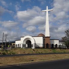
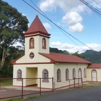
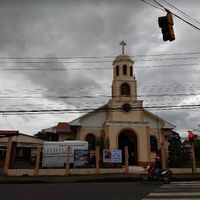
The name refers to abandoned places from the past and reflects in local traditions still practiced in the communities today. Residents regularly gather for celebrations featuring traditional music, dance, and regional food that connect them to their heritage.

The main administrative office is located in Desamparados town, where local government services are based and available to residents and visitors. Multiple national roads run through the canton, connecting the various districts and making navigation between communities straightforward.

A protected natural area called Loma Salitral sits within the canton's boundaries, preserving forest habitat despite surrounding development and expansion. This conservation effort shows how environmental protection continues alongside urban growth in the region.

Location: San José Province

Capital city: Desamparados

Elevation above the sea: 1,161 m

Shares border with: Alajuelita Canton, Aserrí Canton, León Cortés Castro Cantón, Curridabat Canton, Dota Canton, El Guarco Canton, Cartago Canton

Website: http://desamparados.go.cr

GPS coordinates: 9.81333,-84.04889

Latest update: December 20, 2025 13:26

Photos
Reviews

Visited this place? Tap the stars to rate it and share your experience / photos with the community! Try now! You can cancel it anytime.

« Desamparados Canton - Administrative canton in San José Province, Costa Rica » is provided by Around Us (aroundus.com). Images and texts are derived from Wikimedia project under a Creative Commons license. You are allowed to copy, distribute, and modify copies of this page, under the conditions set by the license, as long as this note is clearly visible.

Discover hidden gems everywhere you go!

From secret cafés to breathtaking viewpoints, skip the crowded tourist spots and find places that match your style. Our app makes it easy with voice search, smart filtering, route optimization, and insider tips from travelers worldwide. Download now for the complete mobile experience.

Around Us App Screenshot

A unique approach to discovering new places

Le Figaro

All the places worth exploring

France Info

A tailor-made excursion in just a few clicks

20 Minutes