Mount Talang, Stratovolcano in Solok Regency, Indonesia
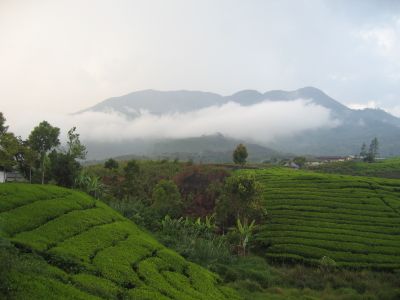
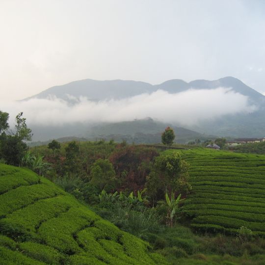
Mount Talang is a stratovolcano in Solok Regency, West Sumatra, rising to about 2,600 meters with multiple crater formations scattered across its peak. The slopes descend steeply and are covered entirely in thick tropical forest that gives the mountain a wild, heavily vegetated appearance.
Mount Talang's recorded eruptions began in 1833; the Smithsonian Global Volcanism Program lists eight confirmed eruptions up to 1968. On 11 April 2005 a minor eruption followed the December 2004 Indian Ocean earthquake, which geologists link to it. Ash fell within a 5 km radius of Aia Batumbuak, dust lay 10 cm deep on roads, a new crater released sulfurous smoke on the south side, and about 25,000 residents were evacuated.
The mountain is also called Salasi or Sulasi. About 160,000 people live in the four districts at its foot — Lembah Gumanti, Danau Kembar, Gunung Talang and Lembang Jaya — roughly a third of Solok Regency's population. The name Talang is also borne by the pitcher plant Nepenthes talangensis, found on the upper slopes.
Mount Talang rises about 9 km from Arosuka, the capital of Solok Regency, and about 40 km east of Padang. Four districts sit on its lower slopes: Lembah Gumanti, Danau Kembar, Gunung Talang and Lembang Jaya, home to some 160,000 people. The summit stands at 2,597 m, and the largest crater lake, Lake Talang, measures roughly 1 by 2 km.
The pitcher plant Nepenthes talangensis, named after the mountain, is thought to grow only on its upper slopes. The species was described from specimens collected on Talang, so the summit vegetation itself carries the volcano's name.
The community of curious travelers
AroundUs brings together thousands of curated places, local tips, and hidden gems, enriched daily by 94,050 contributors worldwide.