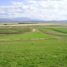
Kameniti Ponor, Höhle in Bosnien und Herzegowina
Location: Federation of Bosnia and Herzegovina
Elevation above the sea: 713 m
GPS coordinates: 43.81673,16.81992
Latest update: November 7, 2025 21:33

Livanjsko Polje
6.1 km
Vladovin Umac
8.4 km
Kravarica
11.4 km
Jurišina Pećina
11.2 km
Mračna Pećina
6.3 km
Hajdučka Pećina
8.6 km
Debela Glavica
10.3 km
Opaki Ponor
456 m
Bristovi Ponor
1.2 km
Velika Pećina
10.1 km
Džajina Pećina
11.8 km
Kozarska Pećina
4.4 km
Jolipova Pećina
4.5 km
Sv. Josip
8.2 km
Archaeological site
6.9 km
Pietà
11.5 km
Stara planinska kuća
6 km
Ruins
6 km
Wayside shrine
6.8 km
Archaeological site
6.9 km
Ranč Lištanac
7.6 km
Nekropola Grborezi
7.1 km
Memorijalni centar 'Rujani'
11.5 km
Wayside cross
11.5 km
Spomen žrtvama komunističkog terora Husina jama
4.8 km
Nekropola stećaka Grepci
8.4 km
Grob fra Lovre Karaule
7.4 km
Monument
10.7 kmReviews
Visited this place? Tap the stars to rate it and share your experience / photos with the community! Try now! You can cancel it anytime.
Discover hidden gems everywhere you go!
From secret cafés to breathtaking viewpoints, skip the crowded tourist spots and find places that match your style. Our app makes it easy with voice search, smart filtering, route optimization, and insider tips from travelers worldwide. Download now for the complete mobile experience.

A unique approach to discovering new places❞
— Le Figaro
All the places worth exploring❞
— France Info
A tailor-made excursion in just a few clicks❞
— 20 Minutes