Cours d'eau du Rang Quatre, hydrologic sink in Ripon, Quebec, Canada
Location: Ripon
Elevation above the sea: 157 m
GPS coordinates: 45.79070,-75.09649
Latest update: November 21, 2025 05:51
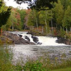
Chutes à Joubert
570 m
Pont Lavergne
2.6 km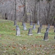
Cimetière des Soeurs de la Providence
8.4 km
Pont Lanthier
3 km
Parc Ernest-Whissell
8.1 km
Pont Mireault
4.5 km
Pont Derouin
2.8 km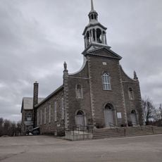
Saint-André-Avellin Church
8.2 km
Pont Sabourin
2.5 km
Rapides des Racines
2.9 km
Chute du Diable
1.7 km
Pont du Village
8.3 km
Pont du Merisier
5.7 km
Pont Foucher
8.2 km
Pont Leduc
7.9 km
Pont Séguin
6.1 km
Pont Leduc
7.5 km
Pont Neveu
425 m
Pont Normand
4.4 km
Pont Paquette
6.9 km
Pont Lemery
6.9 km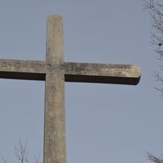
Croix de chemin de la rue Saint-André
8.1 km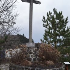
Croix de chemin du rang Sainte-Julie Ouest
5.9 km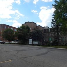
Ensemble institutionnel des Sœurs de la Providence
8.2 km
Pont Bourgeois
6.7 km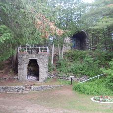
Sanctuaire du Mont-Saint-Joseph
8.3 km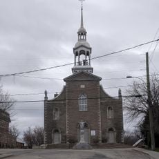
Site patrimonial de la Place-de-l'Église-de-Saint-André-Avellin
8.2 km
Ponceau Montreuil
7.2 kmReviews
Visited this place? Tap the stars to rate it and share your experience / photos with the community! Try now! You can cancel it anytime.
Discover hidden gems everywhere you go!
From secret cafés to breathtaking viewpoints, skip the crowded tourist spots and find places that match your style. Our app makes it easy with voice search, smart filtering, route optimization, and insider tips from travelers worldwide. Download now for the complete mobile experience.

A unique approach to discovering new places❞
— Le Figaro
All the places worth exploring❞
— France Info
A tailor-made excursion in just a few clicks❞
— 20 Minutes