Tschirgant, Mountain summit in Tyrol, Austria
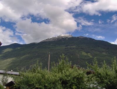
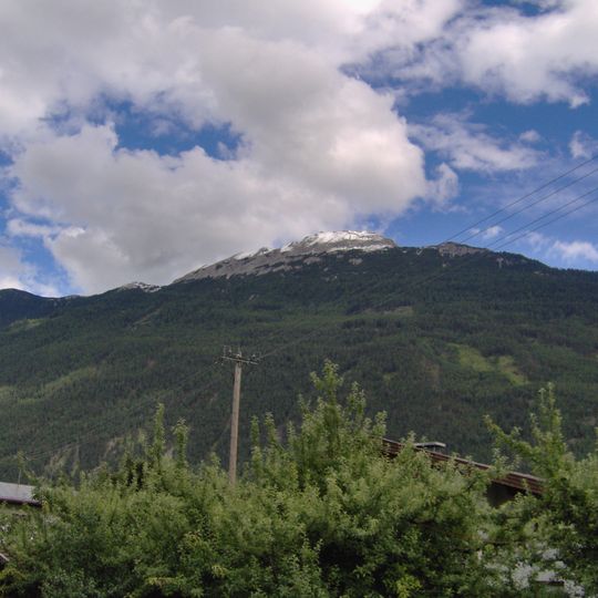
Tschirgant is a mountain summit in Tyrol that rises prominently above the surrounding valleys, featuring sheer rock walls and a distinctive limestone composition. The peak stands out visually within the landscape due to its steep flanks and isolated position.
The name Tschirgant was first recorded in 1459 as Schurgant, probably from an old dialect word for shovel, referring to the peak's shovel-shaped top. From the 15th century, lead, silver and zinc were mined on the mountain near Karrösten. Around 3000 years ago a massive rockslide of 240 million m³ broke off near the Weißen Wand; in 1987 a flood exposed buried tree trunks beneath the debris, allowing the event to be dated.
The name Tschirgant was first recorded in 1459 as Schurgant, probably from an old dialect word for shovel, referring to the peak's shovel-shaped top. Three summit crosses stand on the ridge, each placed at the point most visible from Karres, Karrösten and Haiming. A geo-trail to the Karröster Alm passes former mine entrances and spoil heaps from the lead, silver and zinc mining that began in the 15th century.
Climbing this peak requires caution on steep sections and should only be attempted by experienced hikers. Weather at higher elevations can change rapidly, so proper preparation is essential.
At the main summit point, the municipal areas of Tarrenz, Karres, Karrösten, Roppen and Haiming meet. Three summit crosses mark the most striking points of the ridge as seen from Karres, Karrösten and Haiming.
The community of curious travelers
AroundUs brings together thousands of curated places, local tips, and hidden gems, enriched daily by 94,048 contributors worldwide.