Enable Location

We need your location to show you interesting places around you

Discover nearby places

Find interesting locations and hidden gems around you

Precise directions

Get accurate directions and distances to places

Your location is never shared with other users. It's only used when you tap the location button.

Spitzstein

Log in to your account

Start exploring — it's free

Trusted by 66,472 travelers worldwide

Continue with Google
Continue with Apple
or

We will send you a code to connect

By continuing, you accept our Terms and Conditions and our Privacy Policy

Check your inbox

We've sent a pincode in your inbox. Please enter the code below.

Spitzstein
Discussion Reviews 1 Photos
3.9k Popularity

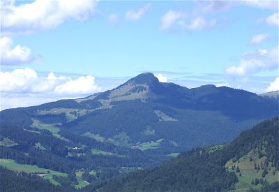
Spitzstein, Mountain summit in Chiemgau Alps, Germany and Austria

Spitzstein is a mountain summit on the border between Bavaria and Tyrol, sitting at around 1,600 meters in the Chiemgau Alps. The peak can be reached from both the German and Austrian sides, with trails starting from several different points in the surrounding valleys.

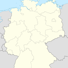
Since the 18th century, the mountain has marked the border between Bavaria and Tyrol, a line that followed the territorial divisions of the Habsburg Empire. This boundary shaped how the communities on either side grew and stayed connected over the following centuries.

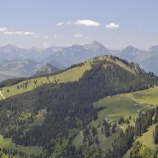
Hikers from both Germany and Austria regularly meet at the top, sharing the same viewpoint across the border. The two summit crosses standing side by side give the place a particular character that visitors from either side tend to notice right away.

Many hikers begin from Altkaser Alm or the parking area near Erl, with the summit reachable in about an hour from either starting point. At this elevation, the weather can shift without much warning, so wearing layers and solid boots is a good idea no matter the season.

Two crosses stand at the summit, one for Germany and one for Austria, placed exactly on the national border line. It is one of the few places in the Alps where an international border runs literally between two summit crosses.

The community of curious travelers

AroundUs brings together thousands of curated places, local tips, and hidden gems, enriched daily by 60,000 contributors worldwide.

Start exploring
Location
Erl
Elevation above the sea
1,596.2 m
GPS coordinates
47.71095,12.24693
Latest update
March 3, 2026 14:02
Reviews
Share your experience

No review yet

Discussions
Start a discussion...

No discussion yet

« Spitzstein - Mountain summit in Chiemgau Alps, Germany and Austria » is provided by Around Us (aroundus.com). Images and texts are derived from Wikimedia project under a Creative Commons license. You are allowed to copy, distribute, and modify copies of this page, under the conditions set by the license, as long as this note is clearly visible.

Discover hidden gems everywhere you go!

From secret cafés to breathtaking viewpoints, skip the crowded tourist spots and find places that match your style. Our app makes it easy with voice search, smart filtering, route optimization, and insider tips from travelers worldwide. Download now for the complete mobile experience.

Around Us App Screenshot

A unique approach to discovering new places

Le Figaro

All the places worth exploring

France Info

A tailor-made excursion in just a few clicks

20 Minutes

Around Us
Travel Guide & Maps
Download

Send to your phone

QR Code
1

Open the camera app on your mobile.

2

Point at the QR code with your camera. A notification will appear.

3

Tap the notification to open the link.