·

Enable Location

We need your location to show you interesting places around you

Discover nearby places

Find interesting locations and hidden gems around you

Precise directions

Get accurate directions and distances to places

Your location is never shared with other users. It's only used when you tap the location button.

Brenntenriegel

Log in to your account

Start exploring — it's free

Trusted by 62,650 travelers worldwide

Continue with Google
Continue with Apple
or

We will send you a code to connect

By continuing, you accept our Terms and Conditions and our Privacy Policy

Check your inbox

We've sent a pincode in your inbox. Please enter the code below.

Brenntenriegel

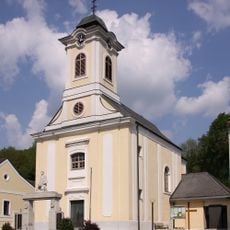
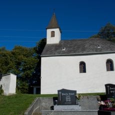
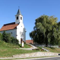
Brenntenriegel, Mountain summit in Sieggraben, Austria.

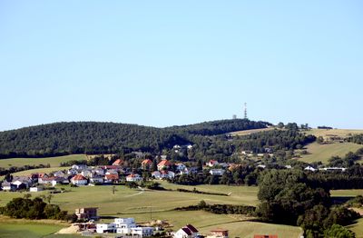
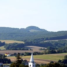
Brenntenriegel is a mountain summit in Sieggraben reaching 606 meters elevation and representing the highest point of the Ödenburger Gebirge range in Burgenland. The peak is dominated by telecommunication infrastructure that serves internet and broadcast signals to surrounding communities.

An observatory was established on the mountain in 1989 by Josef Pratl, then taken over by the local association Sternwarte Brenntenriegel in 2010. Following a renovation in 2018, the facilities were modernized to better serve visitors and the community.

The mountain serves as a central location for astronomical observations and public educational programs through its professional observatory facilities.

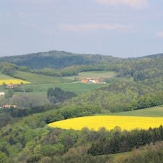
The summit can be reached via various paths from the surrounding area, with forested northern and western slopes offering manageable hiking routes. The southern and eastern sides feature orchards that provide alternate access routes and scenic walking options for visitors.

Multiple satellite dishes occupy the central summit area, while the northern and western slopes feature forest coverage and the southern and eastern sides display fruit orchards.

The community of curious travelers

AroundUs brings together thousands of curated places, local tips, and hidden gems, enriched daily by 60,000 contributors worldwide.

Start exploring
Location
Elevation above the sea
606 m
GPS coordinates
47.65954,16.39067
Latest update
December 14, 2025 18:03
« Brenntenriegel - Mountain summit in Sieggraben, Austria » is provided by Around Us (aroundus.com). Images and texts are derived from Wikimedia project under a Creative Commons license. You are allowed to copy, distribute, and modify copies of this page, under the conditions set by the license, as long as this note is clearly visible.

Discover hidden gems everywhere you go!

From secret cafés to breathtaking viewpoints, skip the crowded tourist spots and find places that match your style. Our app makes it easy with voice search, smart filtering, route optimization, and insider tips from travelers worldwide. Download now for the complete mobile experience.

Around Us App Screenshot

A unique approach to discovering new places

Le Figaro

All the places worth exploring

France Info

A tailor-made excursion in just a few clicks

20 Minutes

Around Us
Travel Guide & Maps
Download

Send to your phone

QR Code
1

Open the camera app on your mobile.

2

Point at the QR code with your camera. A notification will appear.

3

Tap the notification to open the link.